
How often is it that you get an entire complete continent as an FS addon? For sure there have been continent-wide meshes, landlass packages, vector packages and textures, but never an entire continent, complete and whole. Until now. Well, almost, since because of FS limitations (see later) the South Pole itself is not included.

Purchase
Antarctica X is available in two formats. Firstly as a massive
7.3GB download (€34.95), and also as a boxed DVD (€34.99). Not
entirely sure why the very small price difference, but anyhow both
prices include VAT. There is a 10% discount for owners of the
Aerosoft DHC6 Twin Otter (a similar discount exists for Antarctica
X owners wishing to buy the DHC6).
This review covers the download version.

Installation
When you buy the package you will be sent a download link and an
installation key. This is a massive download and it might take a
while depending on your connection (obviously if you have a data
cap on your Internet service, you should look to the boxed version
rather than the download). It took around 2 hours on my
connection.
Since this is such a large download, the first thing you should do
is make a backup. I personally recommend using Network Attached
Storage (NAS) or a USB hard drive dedicated to the purpose, but a
DVD writer will also do. If you can only write single-layer
(4.7GB) DVDs, you will need to unzip the package first and split
it across multiple discs.
With the package unzipped, you can run the installer. This is a
standard Setup.exe, and if you’ve installed other recent Aerosoft
products you will be familiar with the drill. You will need to
enter your key code to activate the scenery, which will be
validated on their server (so you need to be connected to the
Internet for this part). Also, during installation the scenery is
personalised to your particular account, so that should it turn up
on some pirate site in the future, it can be traced back to you.
If you have any Orbx scenery, make sure to set the Orbx region to
Default FSX before you start the installation. Also if you have
NZSI, please be sure to download and install the compatibility
patch from Aerosoft’s forum once your installation has completed.

Configuration and scenery
settings
There is just one configuration setting recommended for this
scenery: “Turn it up to 11”! In reality, Antarctica is a pretty
empty place; there are no trees, few buildings, little traffic,
and so what your PC has to contend with is mostly mesh and
textures. Even moderate hardware can run with maxed out settings;
certainly my i7 doesn’t even blink. A word of caution though, when
you return to Europe or the US for a flight, don’t forget to
return to your previous settings, or you could be in for a juddery
shock!
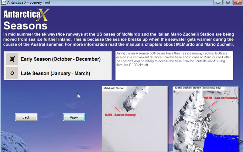
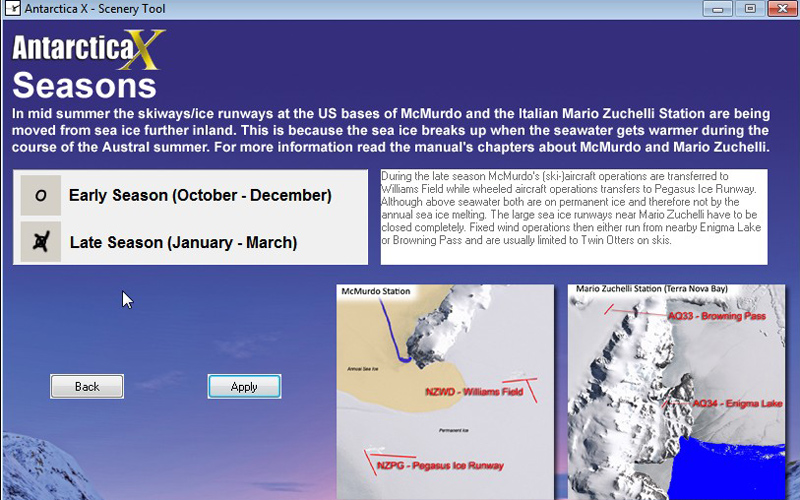
Aerosoft provide a configuration utility that allows the scenery
to be set according to season (because many runways are directly
built on snow and ice, some airports are only usable at certain
times of the year), as well as configuring certain elements such
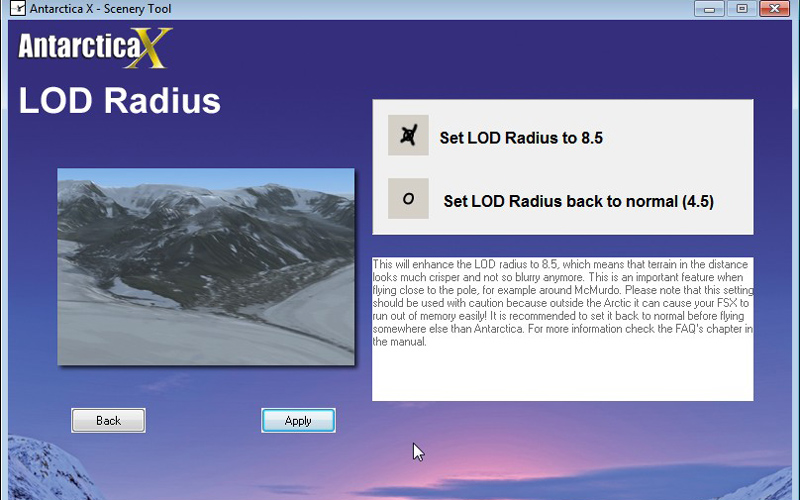
as static aircraft, lighting. This utility also allows Level Of
Detail (LOD) Radius to be set for visual crispness beyond that
normally achievable within the FS settings panel.
 |
 |
 |
 |
Package Contents: Extras and manual
|
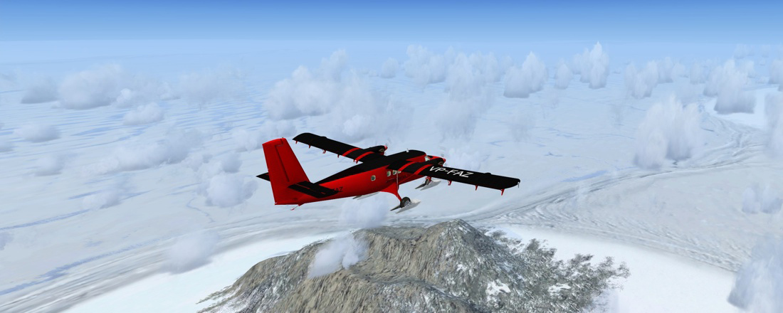
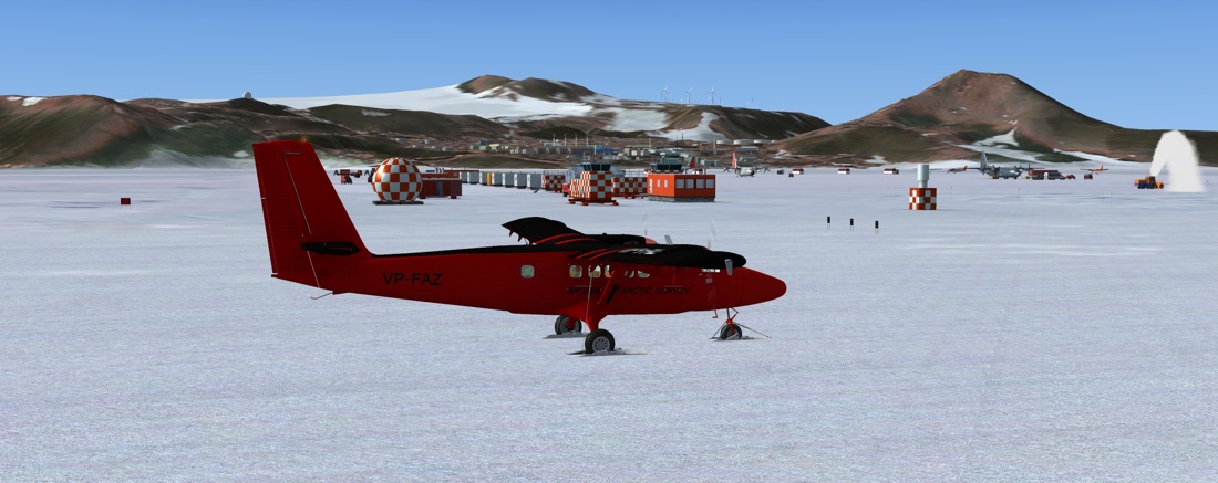
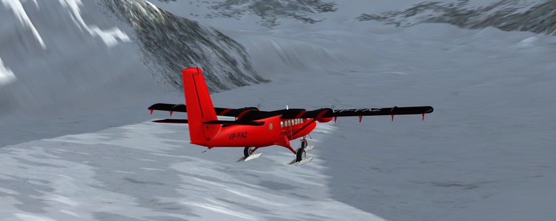
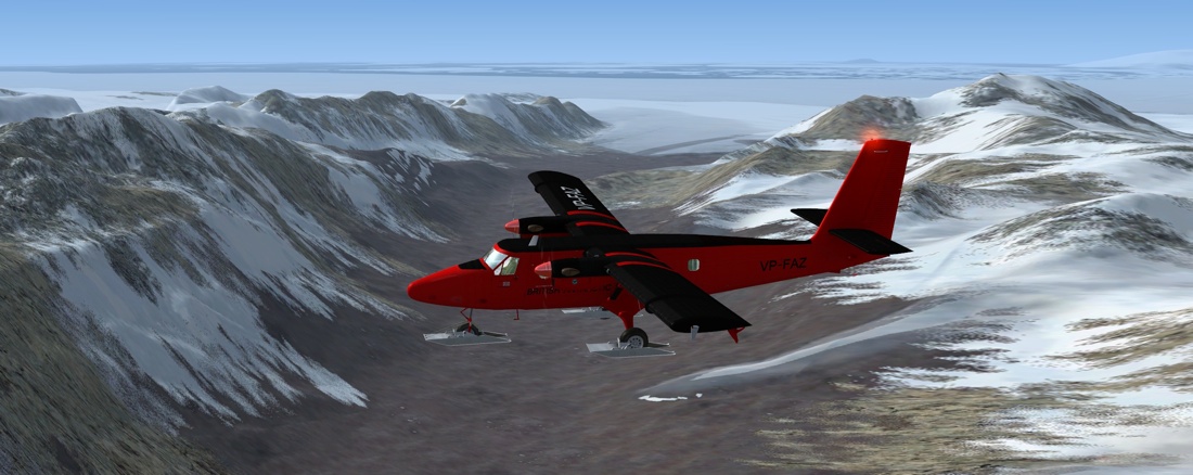
In addition to the scenery itself, the package includes an
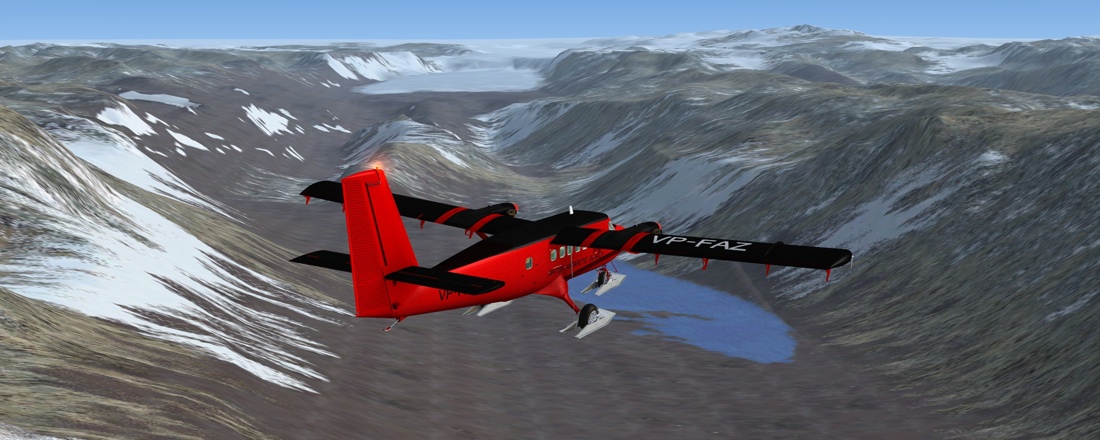
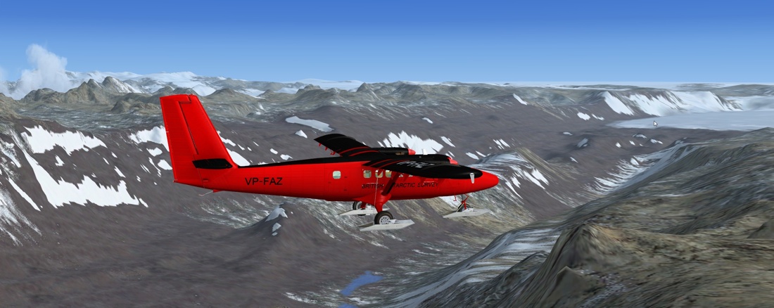
exclusive variant of the Aerosoft DHC6 Twin Otter on skis. This is
in a British Antarctic Survey livery. It’s the fully functional
aircraft although in just the one livery and is not available in
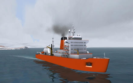
the regular DHC6 package. I’ve used it extensively in the screenshots for this review, and it performs exactly like the regular Aerosoft Twin Otter. There are three ice breakers that roam around the scenery. They have a schedule which is detailed in the manual, so you will be able to find them if you go looking. These ships are extremely detailed, and also have a landable helideck. Two are based on real ships, but the third is fictitious. Also included is a folder containing some 67 flight plans. Mostly these represent Real-World flights both within the continent and also to/from the continent. Plans are also included for the annual ‘migration’ of British Antarctic Survey aircraft North to Canada for maintenance. Two manuals are included, one for the Twin Otter, and one for the scenery. There is also a German language version of the scenery manual. The scenery manual is extensive, and runs to 65 pages long. The manual includes a lot of background detail about flying in Antarctica, including several essays by D. Hardie, a veteran of several seasons flying RW Twin Otters in Antarctica. These cover the topics of general flying, communications, and a flight report of a ferry trip from Calgary in Canada all the way down through Central and South America to arrive at Rothera.  There are further essays on the sometimes brutal history of aviation in Antarctica, common routes and the “airlines” that fly them. This takes up about a third of the manual. The remaining 40 or so pages are devoted to the scenery itself, with maps, charts, descriptions of all the bases and many of the outlying strips, plus an installation guide, tweaks and an FAQ. Rounding out the package, a couple of kmz files show the position of all the bases in the scenery, and also the route for the BAS migration to Canada. |
|
Scenery
I started out with the intention of flying to every strip in the scenery, but very quickly I discovered that this would not be practical in any sensible timeframe (at least not if I ever wanted to get the review written), and so my flights became more selective. Antarctica is big, deceptively so. Partly this is because we are so used to seeing it stretched out along the bottom of a google map. But actually it is 13.83 million square Km, or 1.4 times the size of the USA, or 58 times the size of the UK. So it’ll take a lot of time to explore in its entirety.

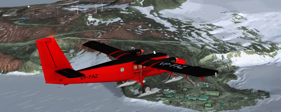
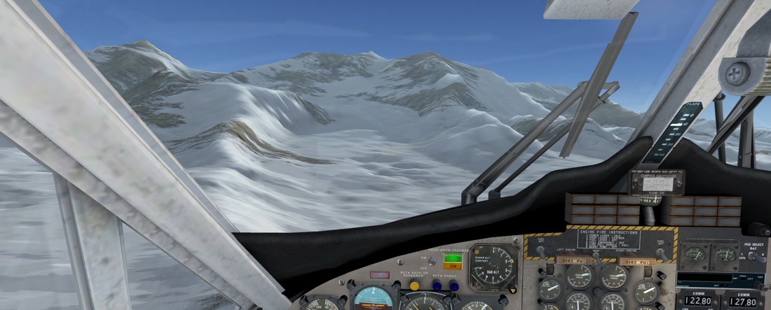
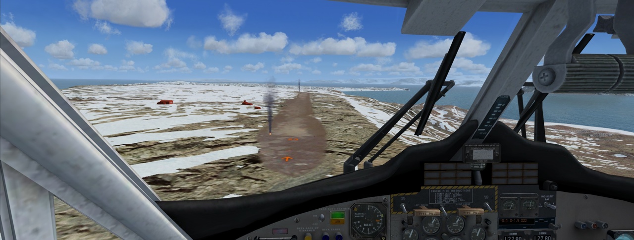
Taking off from Rothera in the BAS Twin Otter
If you’ve flown over snowy, icy areas in FS before (either here in
Antarctica, or in the North), you will know it’s very bland with
little or no gradation – the default textures are basically
limited to sixteen shades of grey, with no detailing. In reality,
there are crevasses, glaciers and such that give the ice a much
more textured appearance. Throughout this scenery, satellite
photos have been used, mixed with landclass to give a very
detailed appearance. However there are still snow fields that are
just blank white stretched out for miles on end, but that’s
because that’s what’s there, rather than it just being some
default.
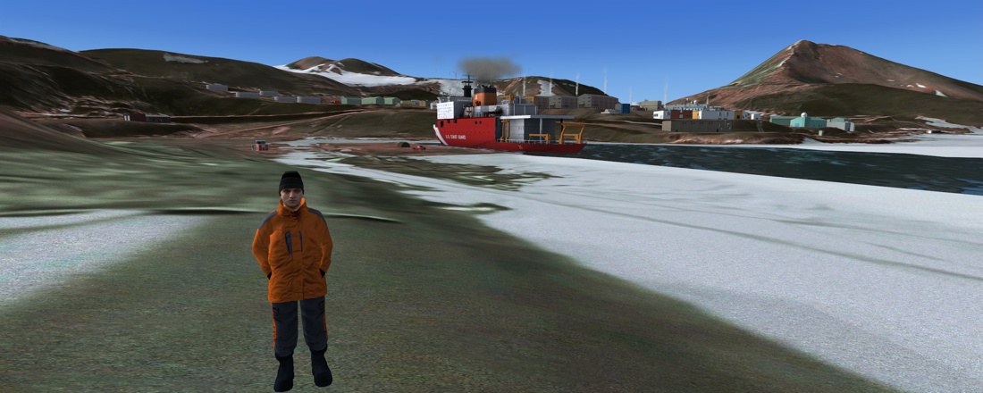
The coastal areas have icebergs and breaking pack ice, so that you
can fly from an area of open water and see the icebergs getting
closer together until they gradually merge into a broken sheet and
finally a solid sheet of ice. You can also see channels that have
been pushed through the ice by the icebreaker ships that are
included in the package (they have landable helipads, although I’m
not competent enough as a helo pilot to manage to land on them.
“Somewhere near the runway” is usually the best I manage on that
score!)

There are lots of small strips included. Many of them you will struggle to find as they are not served by navaids, and their runways are demarked only by flag poles in the snow. Indeed the “communities” these strips serve may only be a few small tents. Sometimes these strips are halfway up the side of a mountain, short and steep – these airfields follow the terrain, and are not constrained by flat FS-style runways – your flying skills will be put to the test, and you will be very glad of the STOL capabilities of your Twin Otter.

The O’Higgins Skiway is typical of many small landing strips
The manual lists 47 named landing grounds, of which 39 are sloped.
Five are helicopter access only.
Seasons
There are essentially just two seasons supplied in Antarctica
X—“Early” and “Late”. So how come? Well, Antarctica is basically
only inhabited during the “Light” months from October to April.
After that, everyone goes home for the Winter and everything
closes down. There is no flying, since it is dark, and therefore
too dangerous, and the few people that do stick it out are
basically prisoners in their bases until the first flight arrives
in the Spring.

Approaching the Ice Runway, Early Season

Late Season McMurdo. The Ice Runway has gone and the breaker
has cut a sea channel
Changing season requires use of the Scenery Tool, and for this to work, FSX must not be running. This is more than simply a change of month, since various airports will be activated or deactivated within the scenery. A side effect of this is that if you use an external flight planner (such as my own Plan-G) or other tool that derives its data from the active FS scenery, you will need to rebuild its database in order for it accurately to reflect the airports and runways that are available.

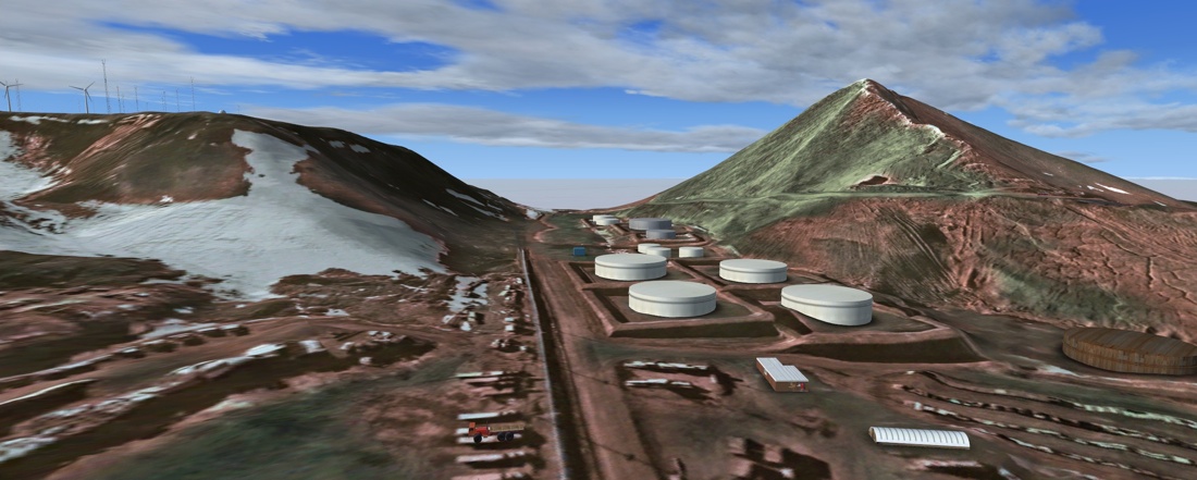
Pegasus, with Mt Erebus and McMurdo behind, Late Season
Impressions
This is what I call an “Oh wow!” scenery. Why? Because every few
minutes when flying it you see another impressive detail and go
“Oh wow!”
Probably the best way to see this scenery is to base yourself at
one of the big main bases and fly from there to the neighbouring
fields. ‘Neighbouring’ is a relative term here, since a round trip
can be easily in excess of 500 miles! Many of the outlying
airstrips serve as forward supply dumps and fuel caches, and many
of the included flight plans represent supply runs to re-provision
these dumps. If you are playing ‘as real as it gets’ and you want
to fly further afield, you will surely be glad of some of these
caches.

Ice can be interesting…
The two big name bases are McMurdo (and Scott, since they are virtually co-located), and Rothera. I spent the most time flying out of Rothera (it is where the BAS Twin Otters live RW), but also flew from McMurdo, and got around to several of the others. All the ‘big’ bases are very detailed, with most if not all of the buildings modeled, optional static aircraft, vehicles, items of interest, and plenty of clutter. Flags, wind turbines etc. are all animated. Runways are textured, and ice runways have been dealt with in such a way as to give them grip, rather than the slip-slidey MS efforts (RW ice pilots say that landing on ice is just like landing on concrete). The big bases are of a standard where you would be happy if you’d bought them separately as small payware sceneries.

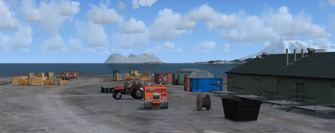
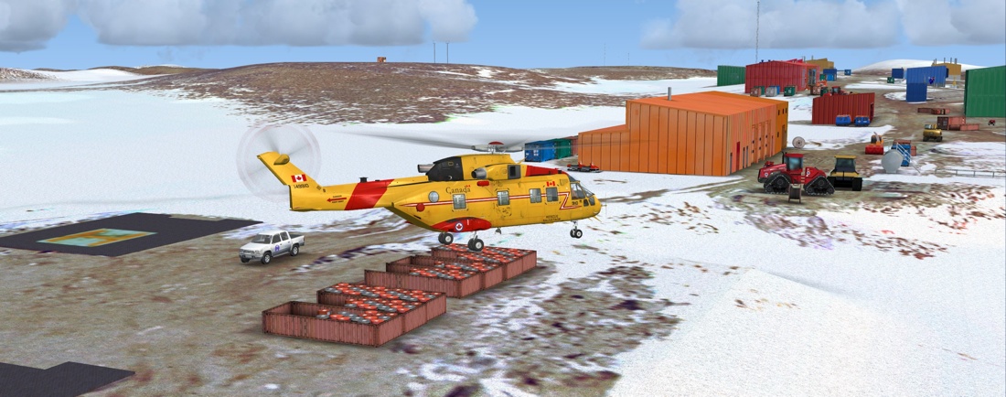
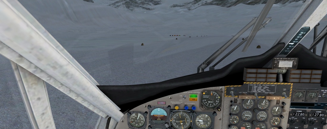
We’re arriving at Sky Blu, a forward logistics camp

The reception party has been waiting for us

Fuel drums stacked in caches, ready to supply ongoing flights
Let’s have a little wander and gain some impressions of each base:
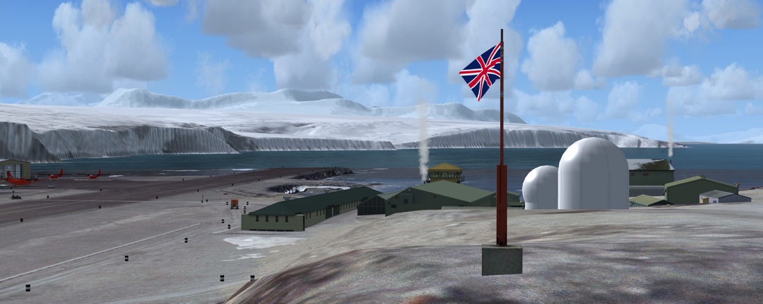
Rothera (UK)
This has to be my favourite location, and not just because I’m
British. It’s very reminiscent of Gibraltar, in that the runway
occupies an isthmus connecting a rocky outcrop to the mainland.
There’s a second, emergency runway up on the glacier, which can be
tricky to find the first time (subsequently you’ll land by
reference to the rocky outcrop rather than searching for the
sticks in the snow!). This runway is used by the Twotters when an
inbound Dash 7 has passed its Point of No return, since the
Twotters can easily land out on the snow, but should the main
runway be blocked, the Dash 7 has nowhere else to go.
 |
 |
 |
|
 |
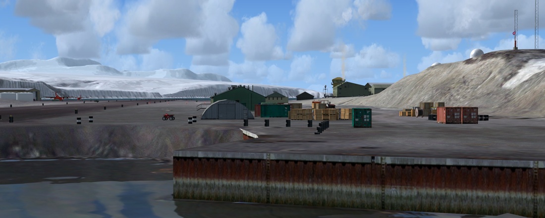 |
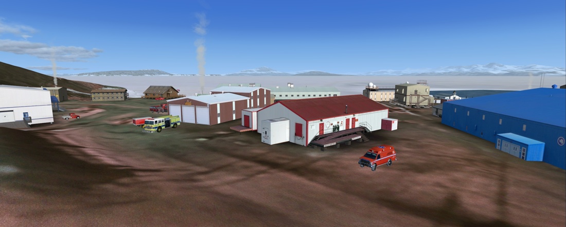
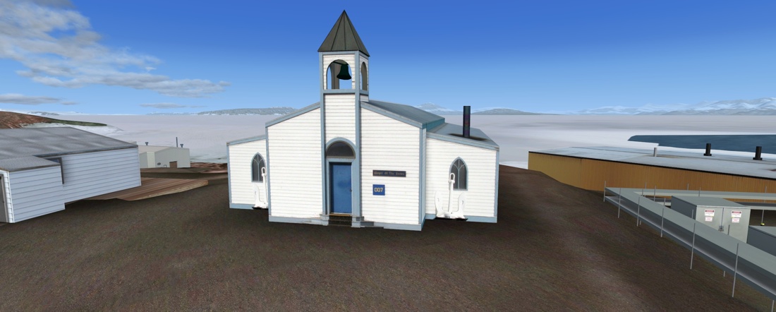
McMurdo (USA)
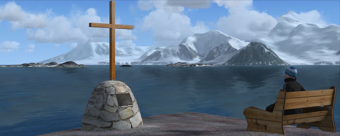
McMurdo is the biggest base in Antarctica, and is probably the third thing most people think of when you mention Antarctica (the first is obviously the South Pole, and the second is Scott’s Hut). Now, while Discovery hut, which was used by Scott on an earlier expedition is modelled (it’s on Discovery Point, quite close to the ice breaker dock), the actual “Scott’s Hut”, situated a few miles North at Cape Evans, isn’t. And this I think is a real shame and a missed opportunity, particularly with this year being the 100th anniversary of Scott’s ill-fated expedition.
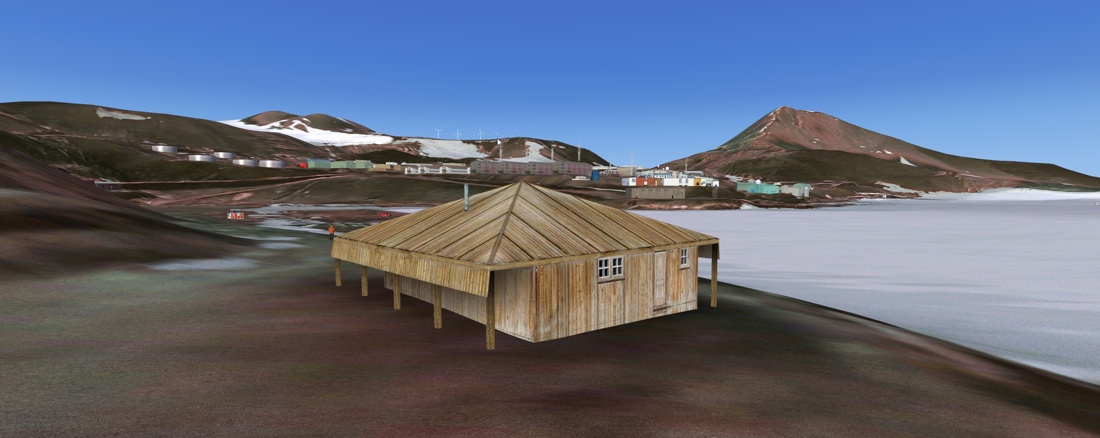 Discovery Hut |
 Cape Evans (site of “the” Scott’s Hut) |
McMurdo shares runways with the nearby Scott Base, and indeed the runways all have New Zealand ICAO registrations. The runways will change according to season. In early season, the Ice Runway (NZIR) is the main runway, but in late season it is closed, and activity moves to Pegasus and Williams.
 |
 |
 |
 |
 |
 |
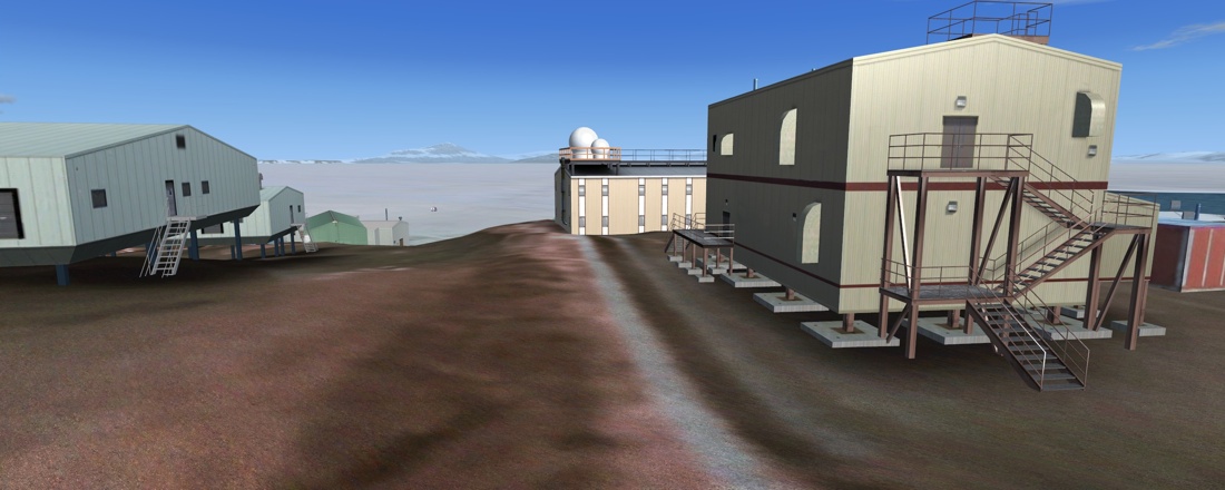
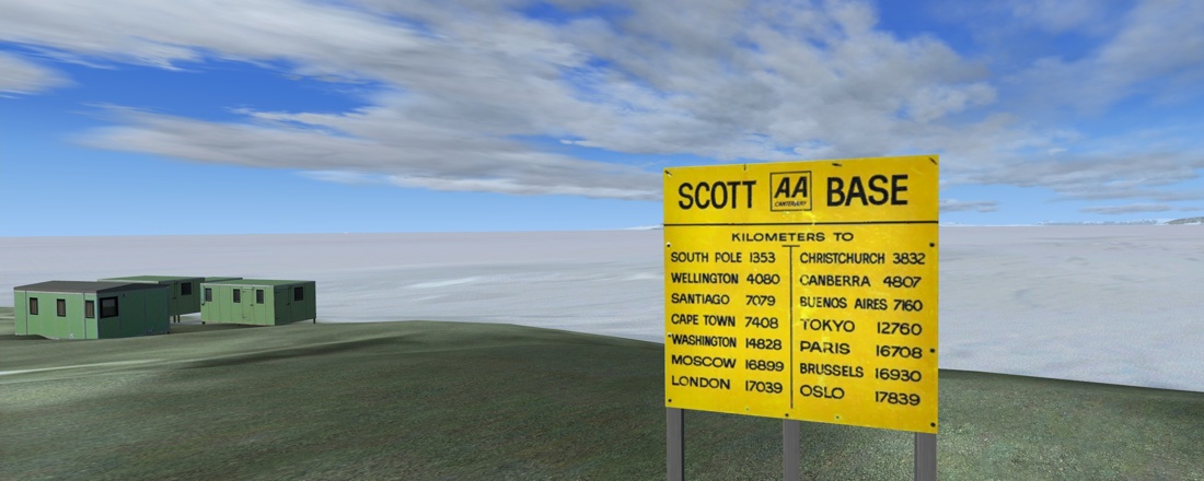
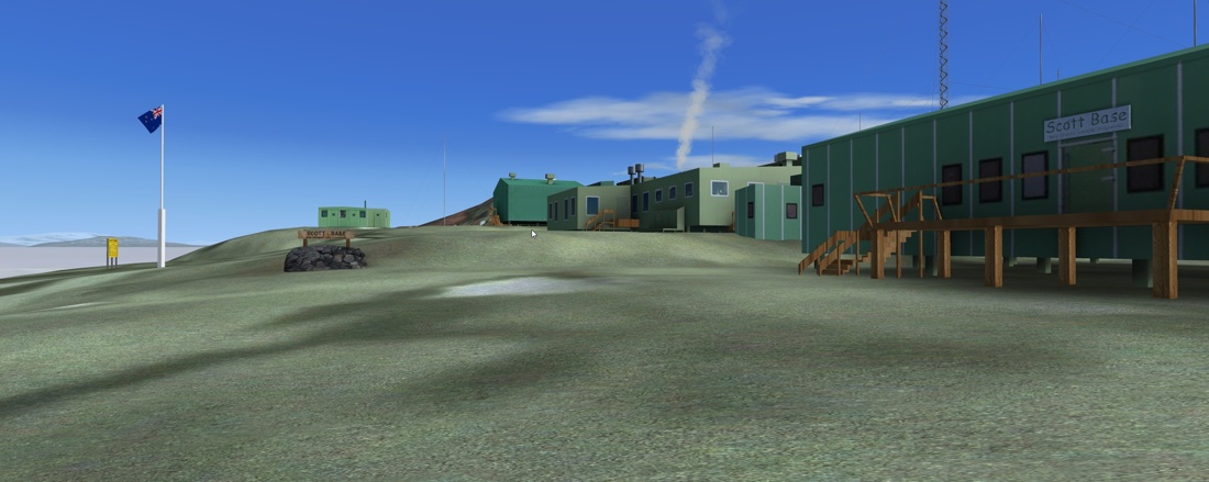
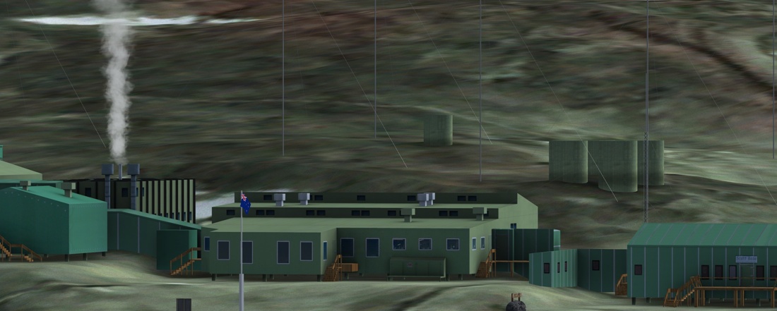
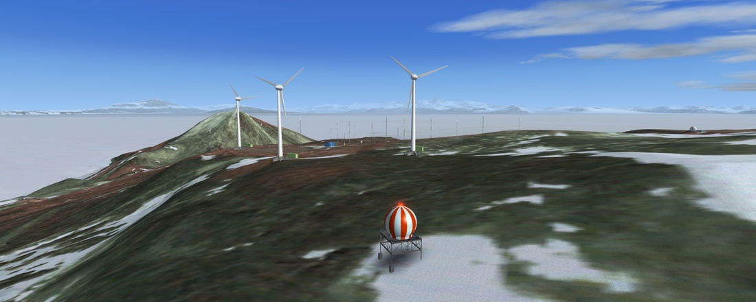
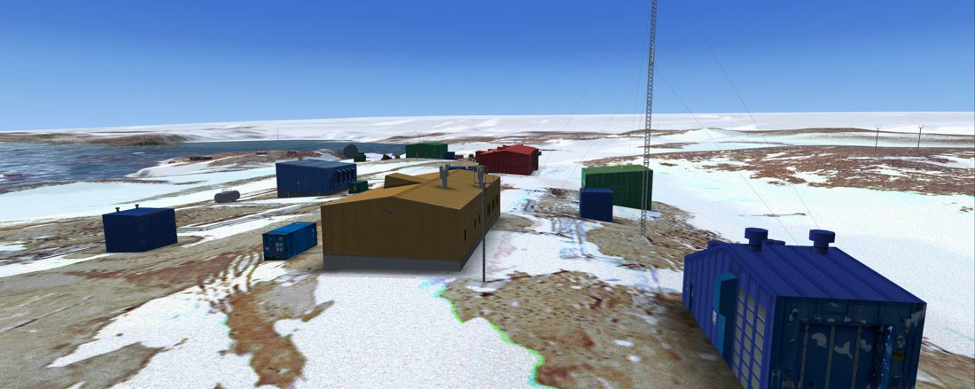
Scott Base (New Zealand)
The Kiwi base is green in more ways than one. Most strikingly, the buildings are all painted that colour, but also it has three massive wind turbines that supply electricity to both Scott and McMurdo bases.
 |
 |
 |
|
 |
 |
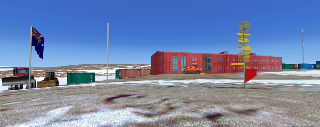
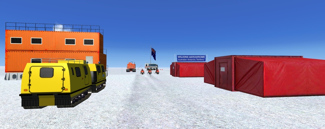
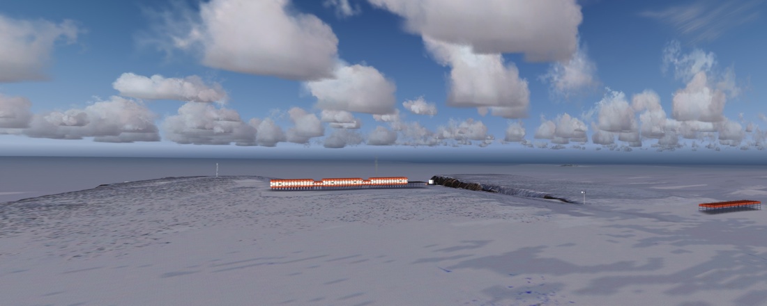
Casey Station (Australia)
The Aussie base is a helicopter-only affair. There are three landing pads here, including an emergency helipad. There’s also a pier for boats to dock (although it’s too shallow for big ships to get right close in to the shore). A track leads to the Wilkins Aerodrome, about 40 miles up the hill to the South, and you can follow it all the way there if you wish. Barrels are placed at regular intervals along the track, acting as mile markers.
 |
 |
 |
|
 |
 |
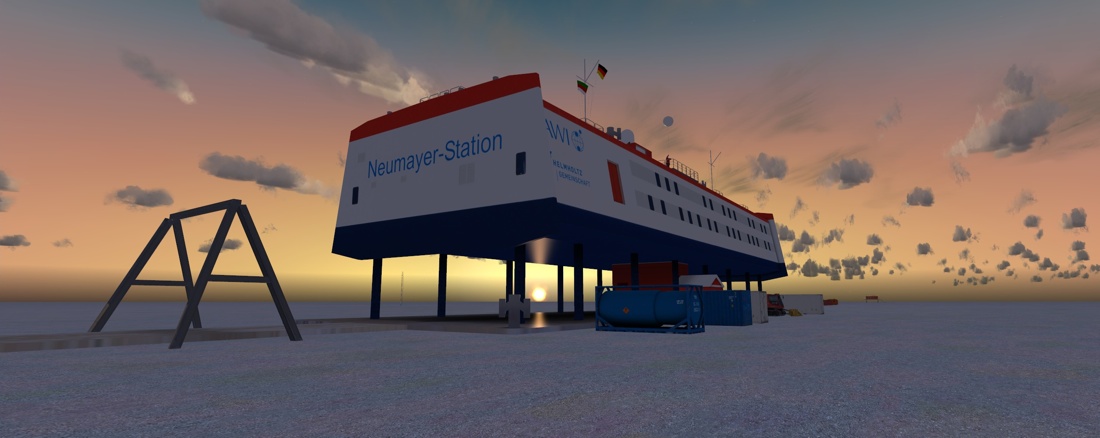
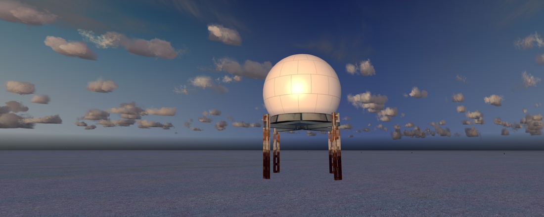
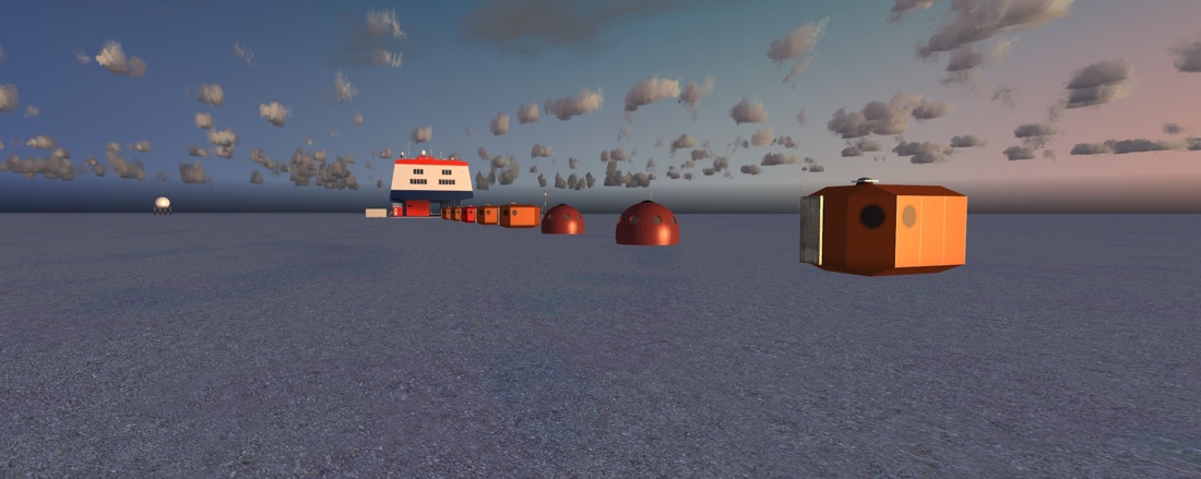
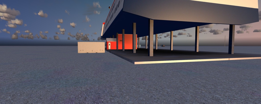
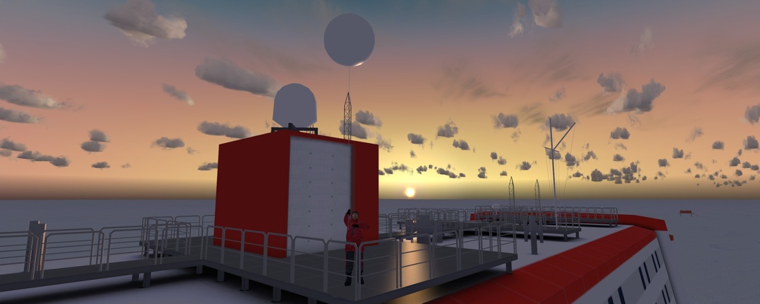
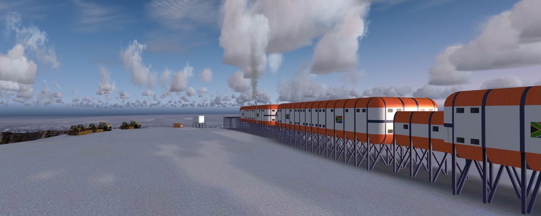
Neumeyer Station III (Germany)
Neumeyer station sits above the Ekström ice shelf like a giant floating container ship, which is essentially what it is. It’s not big, and it’s on a vast snow field, but the devil is in the detail, and this is very nicely detailed, even down to the chap on the roof releasing a weather balloon.
 |
 |
 |
|
 |
 |
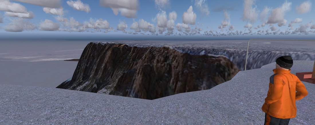
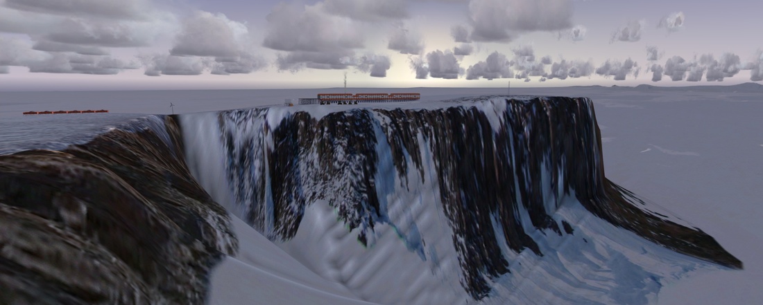
Sanae IV (South Africa)
This based is perched on the top of large steep cliffs, a mountain called Vesleskarvet. There’s a helipad built in to the structure of the base, and it’s very tricky to land here (I’m thankful I don’t have to pay the repair bills!)
 |
 |
 |
|
 |
 |
Some other highlights:
Patriot Hills is a staging camp for tourist expeditions. It also serves as the start point for flights to the Mount Vincent base Camp. Now, if you liked Lukla, you’ll love this one: It’s a 280m steeply sloped snow runway, perched at 7200ft on the top of a glacier… Can you spot the runway?
 |
 |
 |
|
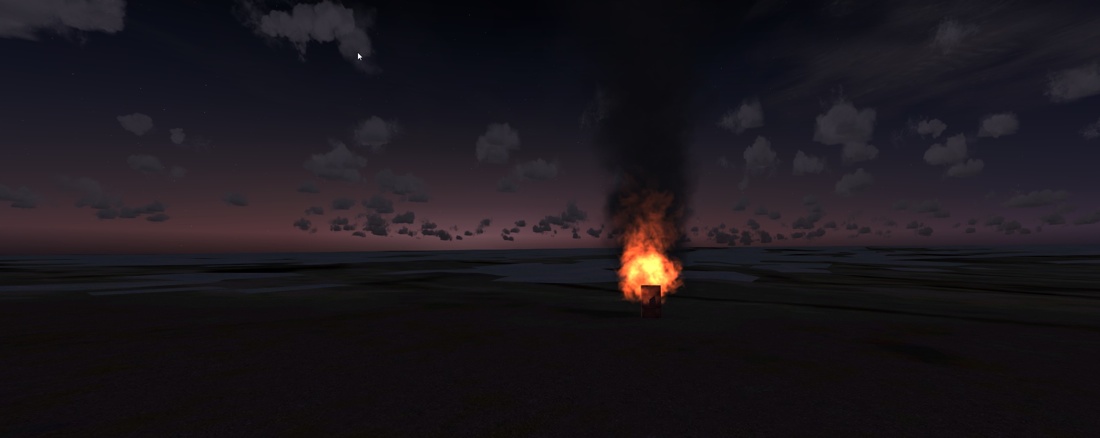
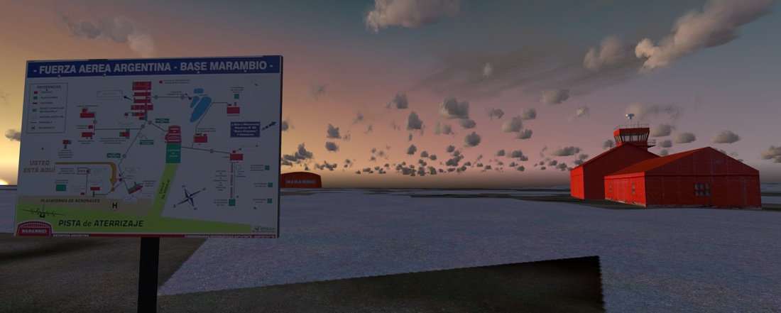
Base Marambio (Argentina) is perched on a rocky island near the tip of the Antarctic Peninsula. It was the first airfield constructed in Antarctica, has WiFi, and the runway is demarked by burning braziers.
 |
 |
 |
 |
 |
|
The Dry Valleys are across the sound from McMurdo. The valleys are free from ice because the high mountains block the ice sheet, and strong katabatic winds sweeping down the mountainsides, which can reach 200mph evaporate any water or ice that might form. There are some lakes in the valleys, these are “hyper-saline”, with Don Juan Pond being the most saline lake in the world with a salinity of over 40%. It won’t even freeze in -40 degree temperatures! Scientists say that these valleys are the closest we can get to replicating the conditions of the planet Mars.
 |
 |
 |
 |
Of course, I took lots more pictures than I could possibly include in the review, and you can see many more screenshots in the review thread on the forum, here: hhttp://forum.mutleyshangar.com/index.php/topic/7216-antarctic-adventure/
Performance
On my PC, at the recommended settings (i.e. everything cranked up to the max), I did not see any degradation in performance.
Limitations
I mentioned at the start that there were some limitations to this package imposed by FSX. When FSX was first launched, Microsoft made a big song and dance about how the world was now round and now included both the North and South poles. What they didn’t tell you is that they didn’t make a very good job of it. Firstly, they caused a lot of compatibility issues with old FS2004 scenery that assumed the world was flat, buy most significantly, the tile system that contains all the scenery textures and terrain features was still based around the old flat-earth system. (Rather like looking at Google maps, the scenery is laid out in a grid, and as you go further South those tiles represent smaller and smaller distances until they all pinch to a point at the pole itself. You can get an idea of this if you look at Antarctica in Google Earth – you’ll see the tiles degenerate into a series of radial lines like the spokes on a wheel. Now imagine that is your scenery, and you can see how things will become very indistinct. Oddly, the weird Stretching effect also happens to clouds.
Microsoft actually did put an airport at the South Pole. It’s there in real life, NZSP, and you can select it from the menus. But good luck if you try to fly there. I did once, and they’ve never managed to find the remains of the aeroplane…
One further complication is that the magnetic South Pole is not in the same place as the ‘true’ South Pole. In actual fact it is off the “south” coast, just outside the Antarctic Circle (although, technically speaking the entire coast of Antarctica is North, by convention maps are drawn with the Greenwich Meridian pointing up, and in this orientation the South magnetic pole is in the bottom right corner). In FS, all navigation instruments work only with respect to the magnetic pole, unlike real life where instruments are recalibrated to True. Consequently your aircraft heading may not be what you think it should be, particularly if comparing it with some third party external flight monitors.

Conclusion
This is a massive scenery, covering a part of the world that few
people know much about (other than that it’s filled with singing,
dancing penguins and BBC Wildlife film crews), and even fewer have
visited. The fact that the developers have persevered over several
years to put together the most complete representation of
Antarctica anywhere has to be something they can be proud of.
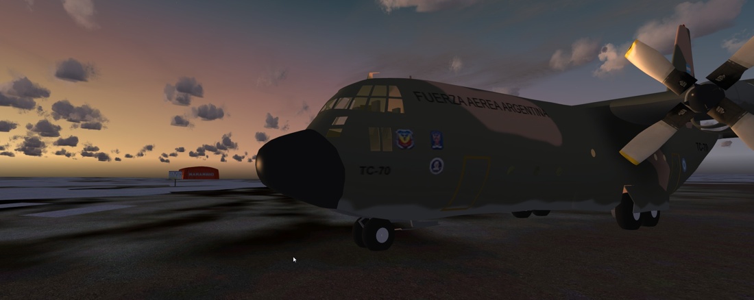
This scenery suits pilots that are happy flying bush planes,
helicopters C130s and at a push A319s. If airline big tin is your
thing, then there will probably be little for you to do.
Fortunately I wouldn’t know an FMC if it bit me, so this scenery
is right up my alley. There are massive landscapes with wide
vistas stretching for hundreds of miles, and there are tiny little
details that you won’t see unless you get out of the plane and
explore down a track or rummage in the clutter. And that will keep
your interest going for a long time.
For sure, not everywhere is represented to the same level of
detail, and there are some limitations of FS that have not been
overcome, but if you want somewhere to explore that is both
challenging, and literally like nowhere you have been before, you
will be very happy with Antarctica X.
![]()
Verdict
I have no hesitation in awarding it
10/10 and the coveted Mutley’s
Award for Excellence. Well done guys.

Aerosoft Antarctica X
![]()
Tim Arnot
Review machine Spec: Core i7-965 O/C to 3.8GHz |
6Gb Tri-Channel DDR3 Ram |GTX560 II 1GB into a TripleHead2Go @ 5040
x 1050 |
Windows 7
64bit
 |
System Requirements
|