Mutley's Hangar
A Haven For Flight Simulation Enthusiasts!

and
AutoGenESis 3D Vol 6-1 North West Scotland
For FSX/Prepar3D Published by Earth Simulations
Reviewed by David 'Dai' Williams
November 2014
Introduction
Photoscenery is not everyone's cup of tea. Many of you may have
tried photoscenery and not found it satisfactory because it can
appear featureless, even if a new, better definition mesh has been
installed together with the photographic ground textures. Most
noticeable is the absence of scenery objects, like buildings, trees,
etc, that come with the default scenery, and produced by the sim's
autogen function. Many photoscenery developers, both freeware and
payware, have ignored this deficiency in the hope that having
photo-real ground textures would provide sufficient immersion for
VFR simmers.
Back in 2008,
Earth Simulations, a.k.a. Darren & Vikki, recognised this was not so, and started the development of a semi-automated method
of producing autogen tree files that could be added to photoscenery.
Darren's previous experience with the Gen-X range (Horizon and
Playsims) led to the development of Treescapes, which, as the name
suggests, adds trees to the photoscenery. Treescapes literally
transformed the relatively featureless landscape of Gen-X into a
living countryside. Initially, the England and Wales regions were
covered. As further photoscenery regions became available,
Treescapes was extended to the areas of Scotland and The Isles.
Around 2009, Earth Simulations had obtained a licence to use the
aerial photographic imagery of Alderney, together with the 5 m
mesh data. Scenery objects were developed for Alderney's main
landmarks as well as a library of generic buildings. With Alderney,
Earth Simulations raised the bar on photoscenery to a new level.
The Scilly Isles and Guernsey were next, followed most recently by
the Isle of Man. The MoD had also commissioned the development of
photoscenery for the area around RAF Shawbury for the Defence
Helicopter Flying School, to be used with specially equipped P.C.
based simulators. Luckily, for us mere mortals, Darren and Vikki
obtained permission to use this development for a flight sim product
and Shawbury Fields was born. Covering more than 3500 sq km, Shawbury's area is bigger than any previous Earth
Simulations product. Whilst Treescapes involved just trees,
Shawbury's development used a novel, semi-automated process to
position generic scenery objects (i.e. buildings, pylons, etc) in
the preparation of autogen libraries. As with Treescapes, by
adjusting the Autogen Density within FSX, the user could obtain the
optimal frame rate for their particular machine.
Earth Simulations have named this mechanism "AutoGenESis". Each
region of their new range of photoscenery, starting with North West
Scotland, is accompanied by an AutoGenESis library pack. This review
is of the combination of the NW Scotland 30 cm photoscenery and its
partner AutoGenESis pack.
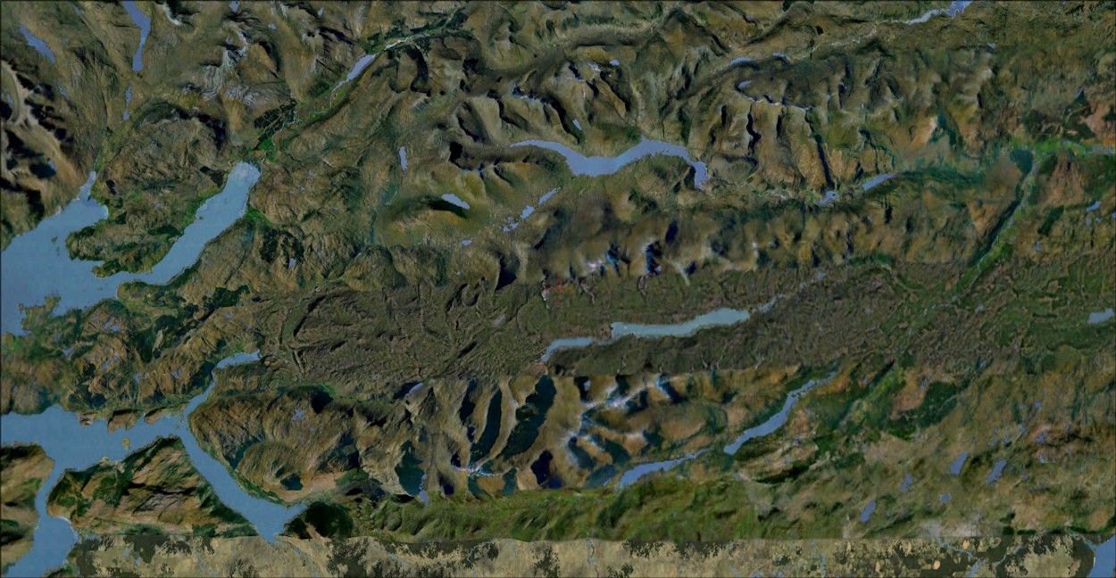
Area Covered by E.S. North West
Scotland
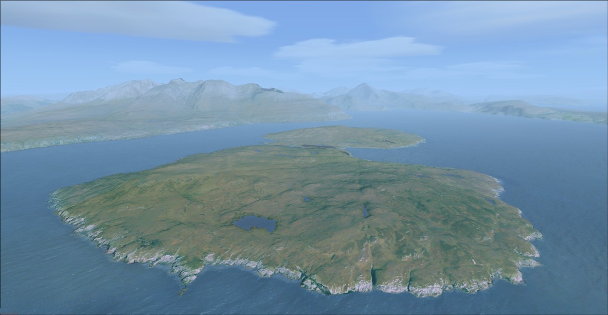
The scenery area is basically mainland Scotland north and west of
Loch Ness, and includes the Isle of Skye, as shown here:
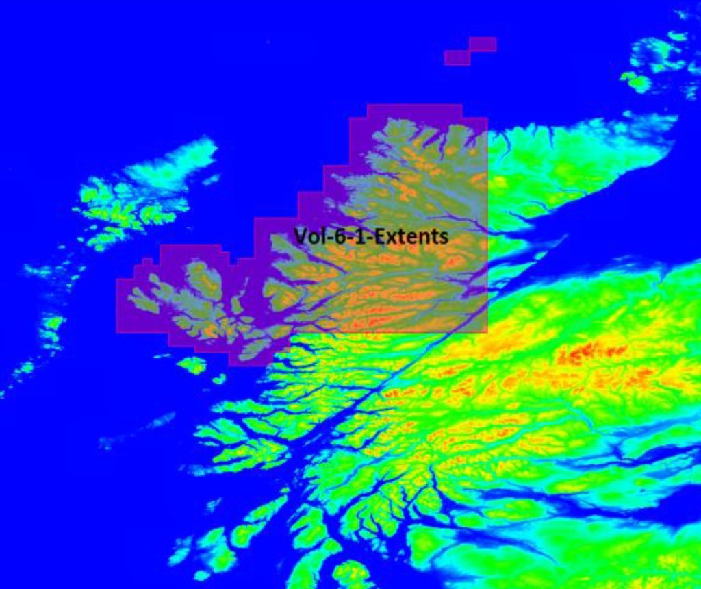
Vol 6-1 Extent
Here's how Earth Simulations will be organizing the remaining 17 photoscenery and AutoGenESis 3D sections.

ES Photoscenery Overview

Vol 6-1 Extent in FSX
With a potential installed size of over 130 GB for the North West Scotland scenery, Earth Simulations have come up with a unique option: have your scenery purchase delivered on a portable disk drive. You may keep the drive after installing the scenery, or you can return it and have a refund of your deposit. There is still a download option - for those lucky to have a fibre-optic broadband connection and patience. After my drive arrived by post, I unpacked it and connected the USB cable. On opening the drive, I found the Autorun.exe application together with the instruction text: "To Begin Start Autorun_exe" - what could be simpler?
Before executing the Autorun.exe, I had a quick look in the main folder on the drive, called "Folders" and some 130 GB in size:
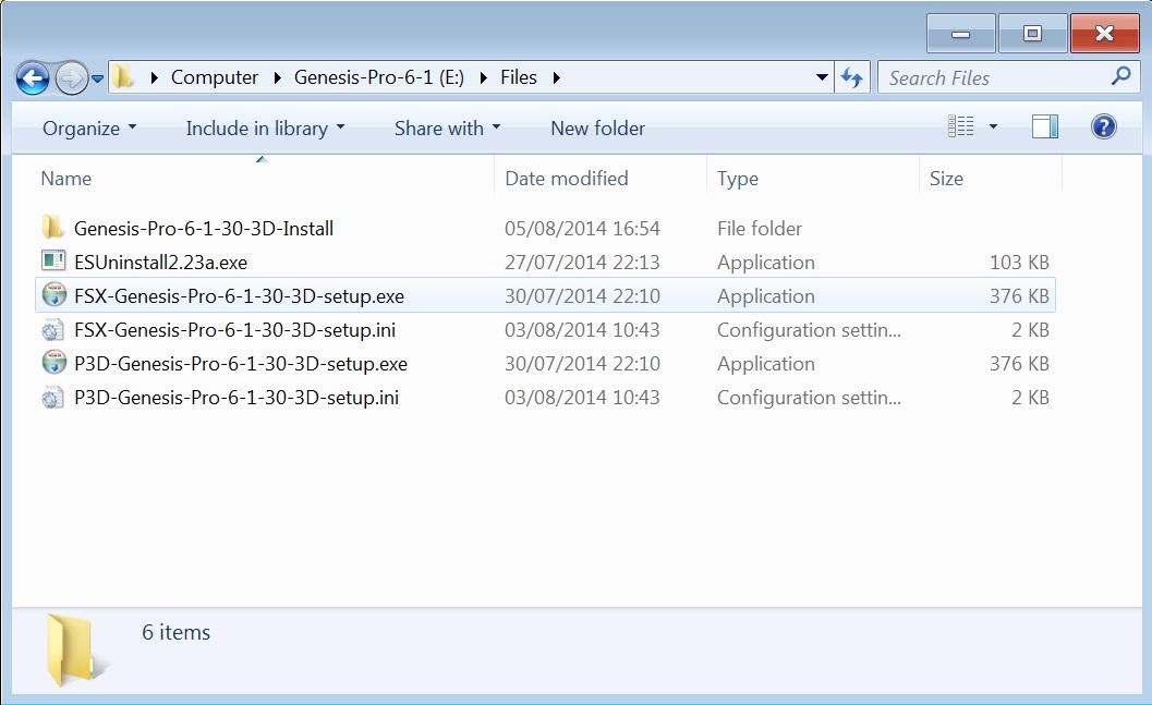
Contents of Files Folder

Contents of the Genesis Folder
C:Program Files (x86)\Earth Simulations, which was 171 GB in size, and contained folders for autogen, sound effects, photo scenery and manuals.
The next step was to fire up FSX. Generating scenery file indexes took 2 minutes and building the new scenery database took a further minute, before the free flight pop-up appeared. The North West Scotland has 2 airports: Plockton and Broadford, and as the latter is on the Isle of Skye, I decided to get my first glimpse of the photo scenery from there. Now, this was crunch time - how long would the scenery take to load after hitting the 'Fly' button? Some 75 seconds was taken up initialising and loading the mesh and a further 40 seconds to complete the scenery, weather, etc. So, less than 2 minutes in total - an encouraging sign.
However, in my enthusiasm, I had missed out an important step! Before flying, I really needed to look up the recommended FSX settings in the manual...
Read The Manual!
Whilst you might try an aircraft add-on without reference to the manual - who hasn't? - this short-cut often doesn't apply with photoscenery. As with all their products, Earth Simulations have gone to a lot of trouble to ensure that you get the best frame rate from your computer system when you've installed their photoscenery into FSX. The manual takes you through the 5 pages of FSX Settings: Graphics, Aircraft, Scenery, Weather and Traffic, recommending initial values for the parameters from which you can experiment to get the best with your particular setup. The procedure didn't take more than a couple of minutes, and the following screenshots show the settings for my review system (see below for detailed specification).
First, Graphics - note the Global texture resolution at maximum, together with Anti-aliasing:
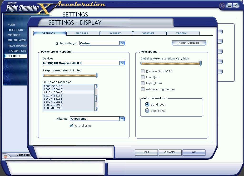
FSX Settings - Graphics
FSX Settings - Graphics
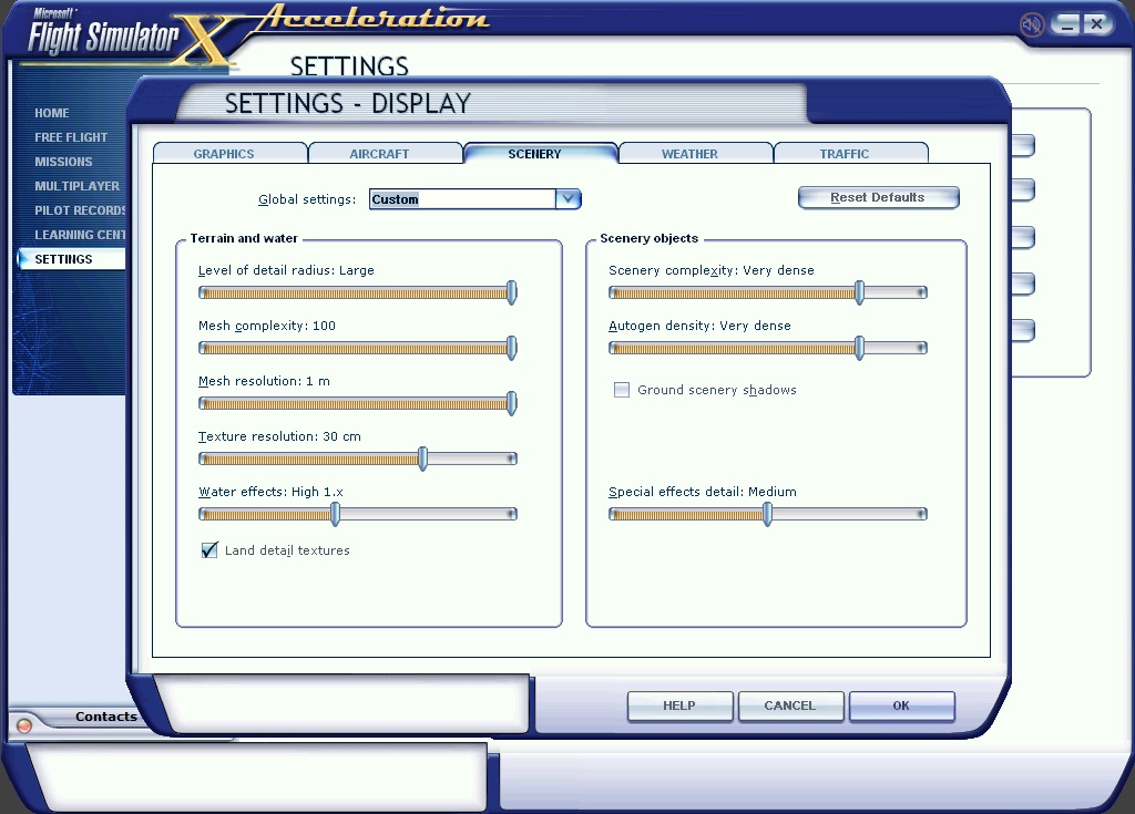
FSX Settings - Scenery
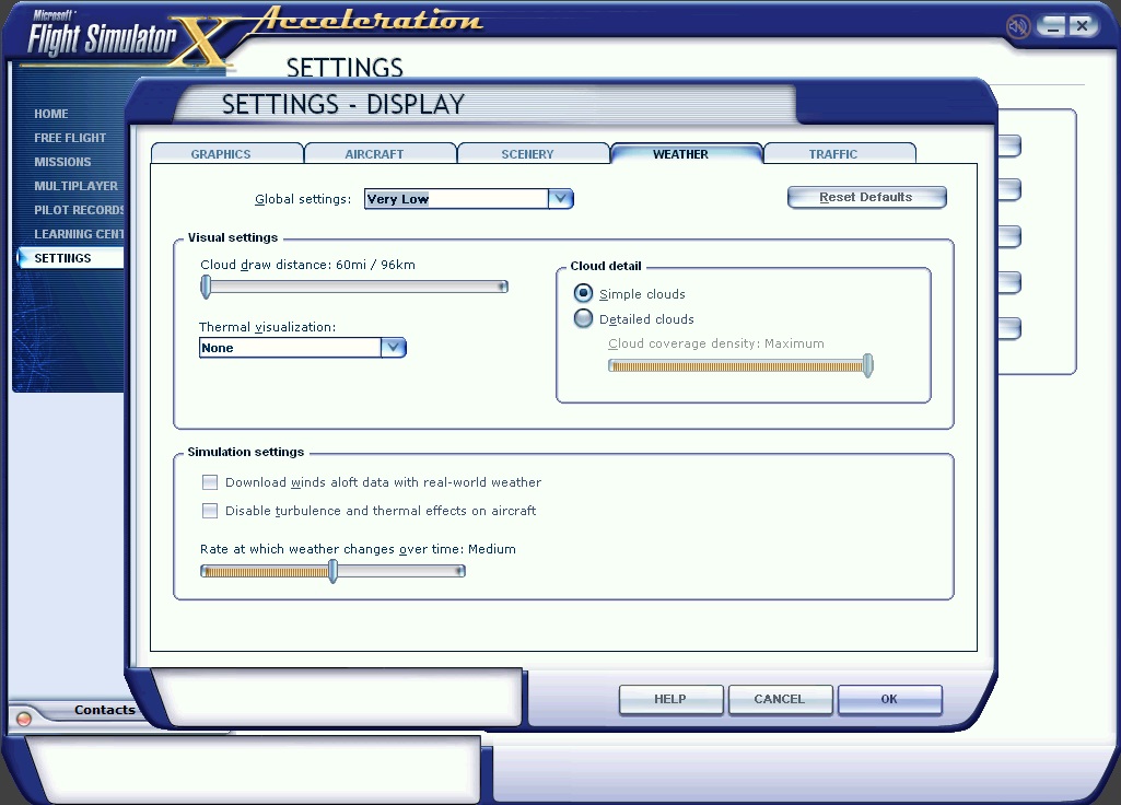
FSX Settings - Weather
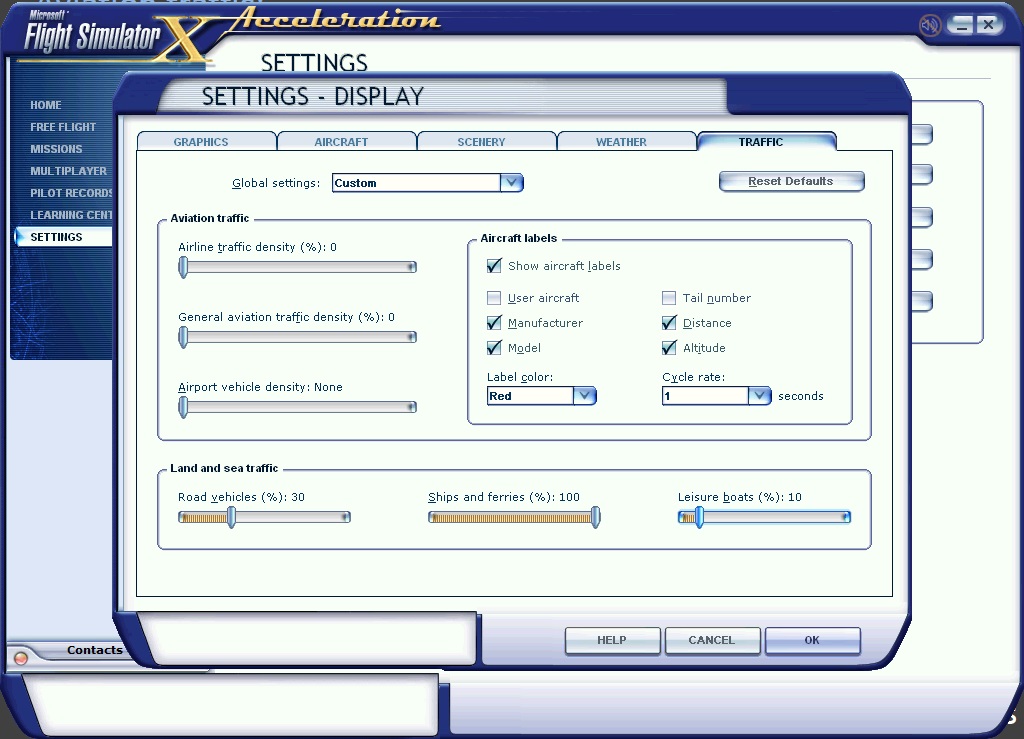
FSX Settings - Traffic
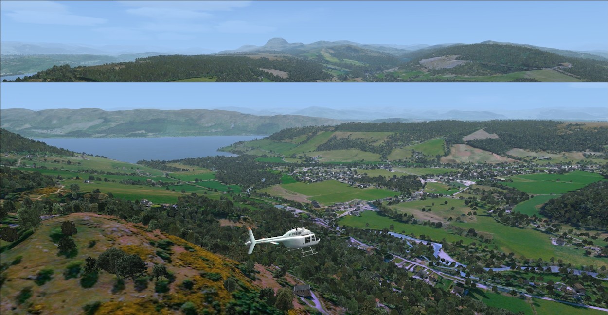
So, I'd done my homework and read the manual - it was time to go. I'd planned a first flight from Plockton - flying south westwards to see the scenery around the Kyle of Lochalsh and the road bridge that links Skye to the mainland. Here's a video I made of the flight, using FRAPS:
Plockton to Kyle of Lochalsh
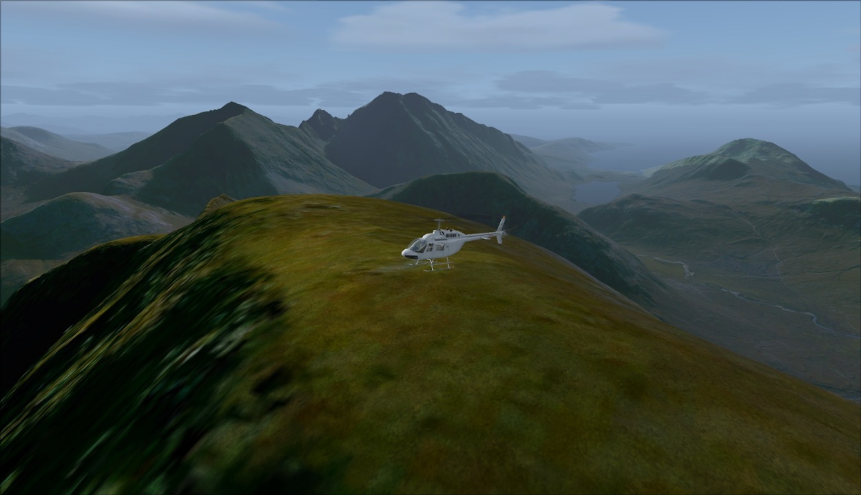
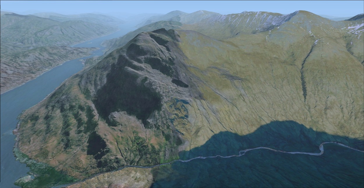
O.K., that was a good result for the seaside, but what would it be like in the mountains? A few miles to the north of Plockton is Glen Torridon, a glacial valley surrounded by some of the most spectacular mountains in the area. So I decided the next flight would be from Kinlochewe, at the end of Loch Maree, to Loch Torridon over the Beinn Eighe and Liathach massifs. I made a video of this flight:
Lochs, Glens and Mountain Ridges
The 30 cm Photoscenery
Earth Simulations have produced their 30 cm photoscenery from updated source data. This is 2x more detailed than existing photoscenery for the UK. This means that you will possibly need a larger HDD than before, but prices for mass storage keep coming down - currently, a 1 TB internal drive costs around GBP 40.00 (Eur 50.00) and a 4 TB version little more than twice this. Remember what size drive you could get for GBP 100.00 when Horizon's Generation-X came out in 2008? The complete 18 sections of 30 cm photoscenery even at, say, 200 GB each, should need less than 4 TB s (3.6 TBs?).
Is the higher resolution worth it? Certainly you're not going to appreciate the detail above 1000 ft AGL. However, for the 'low and slow' advocates amongst us, and particularly helicopter flyers, the 30 cm photoscenery offers an unparalleled opportunity to get close to the terrain without losing the definition that underpins immersion. Airport scenery packs generally don't have this problem of loss of definition because the runways and taxiways are displayed using specifically detailed imagery. But it can be a major problem with landclass based ground texturing, despite the presence of scenery objects like buildings, trees etc, where the image tiles are relatively large. With the 30 cm photoscenery, this definition problem is minimised.
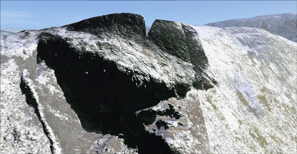
Scenery Detail: Seasonal Variation
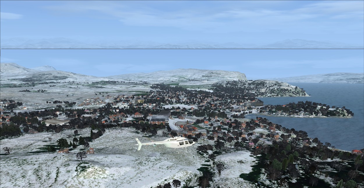
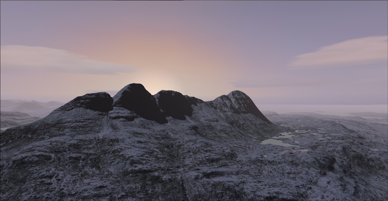
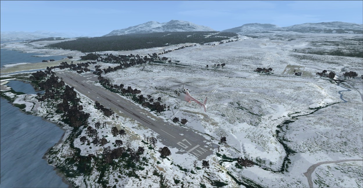
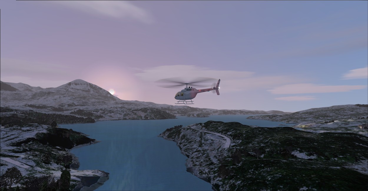
Photoscenery is based on aerial photography made, generally, when the skies are clear. Summer time is ideal for this as the other seasons, particularly winter, are prone to cloud cover. Earth Simulations have taken a radical step with NW Scotland, by digitally processing the summer time photo tiles to produce seasonal variations. This appears to have been achieved by identifying the predominant colour of features like grassland, barren ground, etc., and modifying this colour to represent a different time of year. Thus, each season presents you with different hues on fields, forests, and rocky terrain. When these ground textures are viewed along with the seasonal autogen trees and bushes, the result is quite convincing. Here are a number of screen shots illustrating the seasonal variation:
 Winter: In The Mountains | |
Winter: Over Kirkhill |
Autumn: Bla Bheinn View |
Winter Dusk: Suilven Sutherland |
Winter: Cape Wrath |
Summer: Over Soay |

Summer: Loch Ness South |

Summer: Drumnadrochit |
Summer: Drumnadrochit and Loch Ness |
Night Lighting effects, like Seasonal Variations, are supported by FSX in default scenery, but are usually absent in photoscenery. This is because the daytime ground textures have to be duplicated and then processed to include night lighting splash effects for each source of illumination, like a street lamp or building. Earth Simulations have gone the extra mile to provide extremely realistic night lighting effects - you may have seen this in the first video, here's another example:
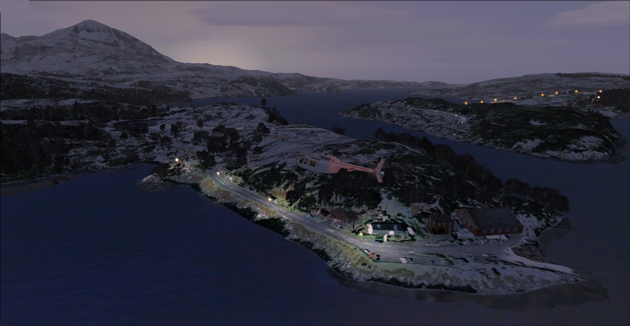
Night Lighting: Kylesku Hotel

Night Lighting: Kyleakin
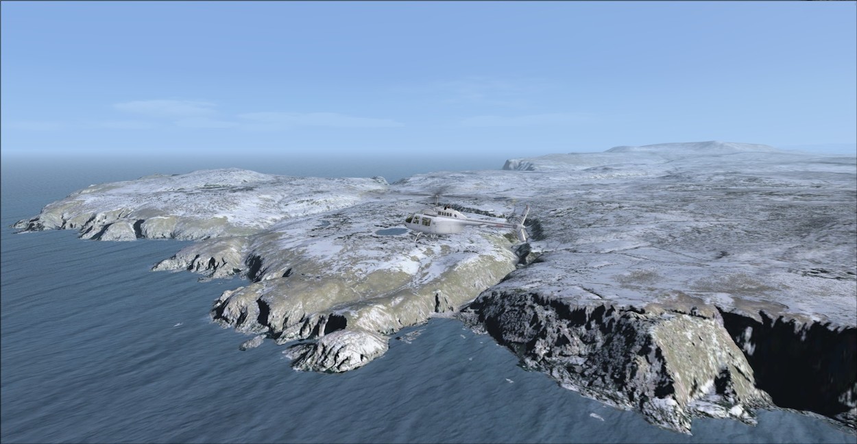
There are only 2 airfields within the area of Earth Simulations' NW Scotland pack: Plockton (UK10) and Broadford (EGEI), together with the heliport at the northern point of Rona. As you can see from the screenshots, Earth Simulations have positioned the runways/taxiways/helipad accurately according to the photoscenery, but omitted to include any airport scenery objects like control towers, hangars, etc. In this, way, Earth Simulations hope to minimise any contention with other add-on airport scenery packs.
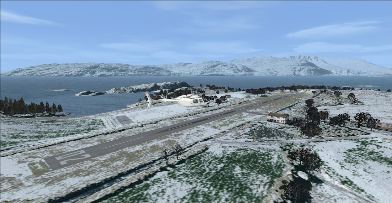 Winter: Plockton Airfield | |
Winter: Broadford Airfield |
Winter: Rona Heliport |
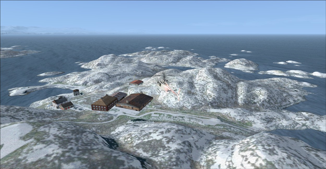
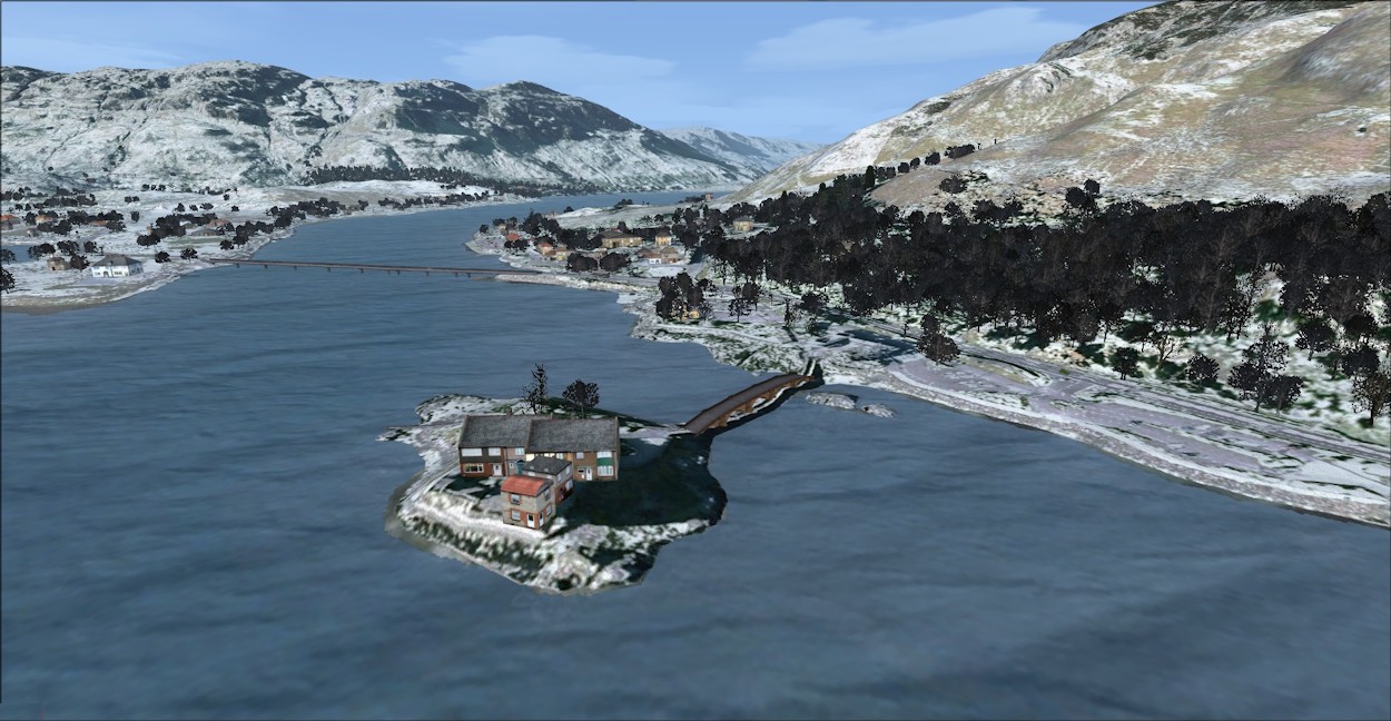
In addition to autogen, Earth Simulations have included a small number of specific objects, like the Skye Bridge, which have been specifically designed for the photoscenery. Other bridges, like that on the approach to the Skye Bridge, are stock scenery objects either from the default FSX libraries, or from Earth Simulations' own extensive libraries of scenery objects.
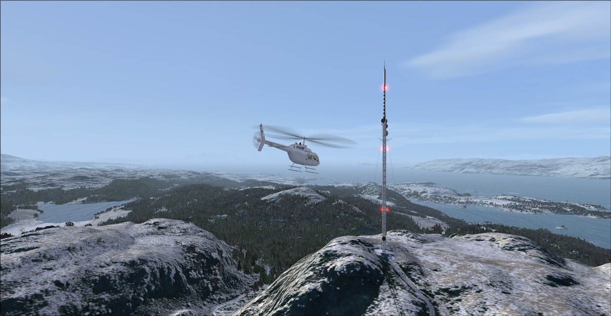
Plockton Mast |
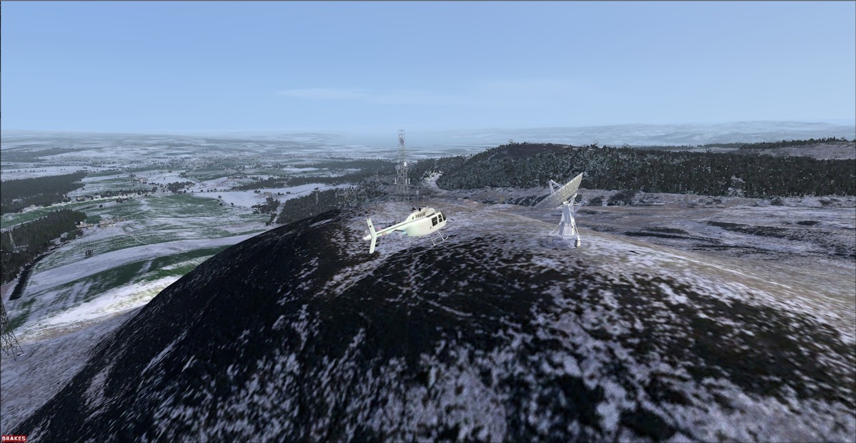
Winter: Radio Telescope |
Earth Simulations haven't duplicated the efforts of other scenery add-on developers, like ScotFlight. So, there are omissions, like the missing bridge at Kylesku and the castle at Eilean Dunan, where autogen buildings attempt to represent the ancient buildings.
Kylesku Bridge Site |
Eilean Donan Castle |
The raw images from the aerial photography are grouped in bands, captured as the aircraft (or satellite) passes over the terrain. Several passes will be required to build up a complete picture of the region - for NW Scotland about a dozen or more bands are required. In mountainous terrain, like Scotland, it is important that the images are captured so that shadowing is consistent, so the photographs are best taken at similar times of the day. However, difficulties can arise when this is not possible, and further processing is needed to blend disparate bands together. Here's a top-down view showing this problem in a band that passes through Loch Affric, north west of Loch Ness.
Aerial Photography Bands
Blended Interface: Summer
Blended Interface: Winter
Compatibility with ScotFlight Scenery
ScotFlight produce an excellent set of scenery packs for Scotland, including one to complement the Horizon/PlaySims Generation-X photoscenery. Other packs are available for default FSX and Orbx Scotland landclass tiles. At the time of writing, however, Scotflight have not committed to producing a variant specifically designed to be compatible with the Earth Simulations product. To match the 5 m mesh, the Generation-X option is currently the most suitable. Unfortunately, conflicts are possible when you install the ScotFlight scenery objects, both with the hand placed ES scenery items and autogen (AutoGenESis). As more Earth Simulations regions are announced, ScotFlight will probably be more confident to invest the time required to produce a compatible option, but this is uncertain.
Conclusions and Summary
With their NW Scotland 30 cm photoscenery, Earth Simulations have raised the bar, yet again. When Shawbury Fields came out, in 2011, I remember thinking how great it would be if this could be extended to the whole of the U.K. Well, Darren and Vikki have started to do just that with NW Scotland. O.K., I'll confess that I prefer photoscenery for areas that I know well, as landclass tiles tend to clash with one's own memory of the scenery. With areas of the world that I'm not personally experienced with, then landclass is fine. So, I'll admit to a certain bias towards photoscenery for the U.K. and with the addition of well designed autogen, in this case AutoGenESis, the Earth Simulations product is possibly the best photoscenery I've come across.
As you saw from the videos, frame rates are good, but as this depends on the CPU/GPU combination used, you will need to take care that your slider settings can be accommodated by your particular set up. This aspect is covered in the Manual, which has been produced to Earth Simulations' usual high standards.
However, there are some drawbacks. The basic summer photo textures are excellent - even taking the photo-capture banding discontinuities into account - but the seasonal variations do not do justice to real winter conditions, which is a pity. Nonetheless, the NW Scotland product is, I think, the first photoscenery that provides all 4 seasons. Couple this feature with the brilliant night textures, and you have a truly unique product.
Another possible drawback is the compatibility problem with the ScotFlight scenery, but this situation can only improve in time as more regions are covered by Earth Simulations.
So, value for money? Comparing products is not straightforward: Earth Simulations are to cover Scotland and the Isles with 9 regions, while the Gen-X has, I think, only 5. Prices for both are similar - around GBP 30.00 - however, the 30 cm Earth Simulations photoscenery contains 4 times the detail of the Gen-X 60 cm product. AutoGenESis adds around GBP 15.00 per Earth Simulations region (when purchased alongside the photoscenery), whereas the Treescapes regions can be as low as GBP 10.00 per Gen-X region. Remember, Treescapes provides only trees/shrubs, unlike AutoGenESis which includes buildings as well. My feeling is that the higher definition and autogen buildings makes the extra price worthwhile if only for the improved sense of realism, which adds to the immersion immensely.
Product Links
North West Scotland 30 cm photoscenery here:
//earthsimulations.com/product/photogenesis-30cm-vol-6-1-scotland-nw-pro/
North West Scotland AutoGenESis here:
//earthsimulations.com/product/autogenesis-3d-volume-6-1-scotland-north-west/
Review Computer Specifications
The specifications of the computer on which the review was conducted are as follows:
● Chillblast Tiger Moth (Fusion laptop);
● Processor: i7-4710MQ CPU @ 2.50 GHz;
● Bus type: 64 bits;
● Ram: 8 GB;
● Hard Drive: 1 TB Hybrid SSHD;
● GPU: nVidia GTX 860M;
| Scores: |
 | |
| ● Scenery Coverage: | 9.0/10 | |
| ● Level of Detail: | 9.0/10 | |
| ● Quality of Scenery Objects: | 8.0/10 | |
| ● Performance: | 9.0/10 | |
| ● Value for Money: | 9.0/10 | |
| ● Documentation: | 10/10 |
Earth Simulations PhotoGenESis 30cm Vol 6-1 North West Scotland and AutoGenESis 3D Vol 6-1 North West Scotland are awarded an overall Mutley’s Hangar score of 9.0/10, with a "Highly Recommended" and a Mutley's Hangar Silver Award. |
![]() = External link, Mutley's Hangar holds no responsibility for content in these links : Mutley's Hangar
© Joe Lawford 2006 - 2014 All Rights Reserved. E&OE
= External link, Mutley's Hangar holds no responsibility for content in these links : Mutley's Hangar
© Joe Lawford 2006 - 2014 All Rights Reserved. E&OE
Disclamer