Mutley's Hangar
A Haven For Flight Simulation Enthusiasts!

For FSX/Prepar3D Published by Orbx
Reviewed by Brian Buckley
November 2015
Introduction
Eagle County Regional Airport, sometimes referred to as Vail/Eagle
Airport or the Eagle Vail Airport, is a public airport located
4mi (6km) west of Eagle, Colorado, USA. The airport
serves its namesake Eagle County, which includes visitors to the
nearby Vail and Beaver Creek ski resorts. It covers 632ac
(256ha) and is configured with a single runway. Eagle County
Regional Airport was rated 8th on a list of most extreme airports in
July, 2010 due to the elevation, weather variability, an approach
through mountainous terrain and challenging departure procedures. In
2008–2009, the airport completed a runway repaving and extension
project, increasing the runway length to 9,000ft. This enables
aircraft to take off with more passengers and fuel and the
capability to serve longer distances.
The airport is mostly seasonal, with the greatest number of
scheduled flights operating during the winter months. During the ski
season, KEGE is the second busiest airport in Colorado after
Denver International Airport. Eagle serves as a good alternative
to Denver for skiers in the Vail Valley because of its close
proximity to the major international ski resorts of Vail, Beaver
Creek, Copper Mountain, Keystone, and Breckenridge. Due to the
abundance of flights into KEGE and the ability to accept larger
aircraft than Aspen, during the ski season, a number of passengers
fly into KEGE rather than attempting to fly into Aspen. Operations
into the airport during the summer months have proven to be
increasingly popular with tourists, with United Express offering
service year-round and with American Airlines serving the Airport
during the summer months from June through to September. Eagle County
Airport is also extremely popular with private aircraft operators
and has one of the top rated Fixed Base Operators in the country,
based at the Vail Valley Jet Centre. Due to the wide variety of
private and commercial aircraft, CNN rated KEGE as one of the
world's top places to spot aircraft.

Terminal
Availability and Installation
FTX: NA KEGE Eagle County Regional Airport is available from The FlightSim Store as a 'download only' product (a master back-up DVD service is also available for a minor additional cost). It is priced at AUD$32.95, or the equivalent on currency cross rates. The download file size is 2.58GB and a key code is issued via email and required during installation. The installation process is easy and intuitive and the scenery installs seamlessly as part the FTX Central 2 application. As with any Orbx product, it is highly recommended that after installing the product, you install or reinstall the latest version of the Orbx Scenery Libraries (ORBXLIBS).
Terminal
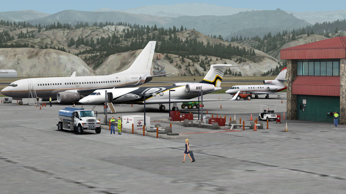
Jarrad has produced another highly detailed airport with extensive coverage through part of the most beautiful scenery in Colorado, USA. Not only has he rendered the main Eagle County Regional Airport but there are also three other locations to land your aircraft, either fixed wing or rotary wing. There is Gypsum Creek Ranch Airstrip (CO47), which is located SSW of KEGE and is just a dirt strip, Avon STOLport (WHR) located east of KEGE, and a heli-pad located at the Vail Medical Centre which, if you follow the I70 further east of Avon, you will find it next to the Interstate in Vail. Although these three additional landing areas have been included, they are only lightly rendered compared to KEGE. Also, Avon STOLport is of particular note, as locals may recognise that this airstrip has been shut for many years. This depiction shows it in mid 1980s configuration, although for those seeking a truly authentic experience, this can be disabled via the control panel in lieu of the present day layout.

 WHR - Avon STOL port |
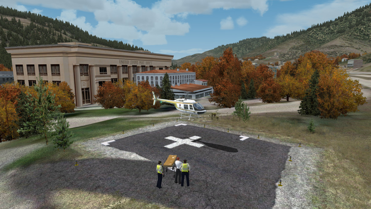 Vail Medical Centre |
 C047 - Gypsum Creek Ranch |
 KEGE - Eagle County Airport |
Covering a huge 1500km² encompassing the towns of Vail, Eagle, Gypsum, Avon, Beaver Creek, Eagle-Vail and Walcott, with huge tracts of mountainous terrain, Orbx FTX KEGE gives us more than enough scope for exploration of the towns, and varied landscapes of this area. The Colorado Rockies boasts some of the most breathtaking scenery in the world and there is plenty of eye candy included to have us based here, for a while at least. The huge area included in this scenery is shown below.
 Coverage
Map
Coverage
Map Area
Covered
Area
Covered
 Google Earth |
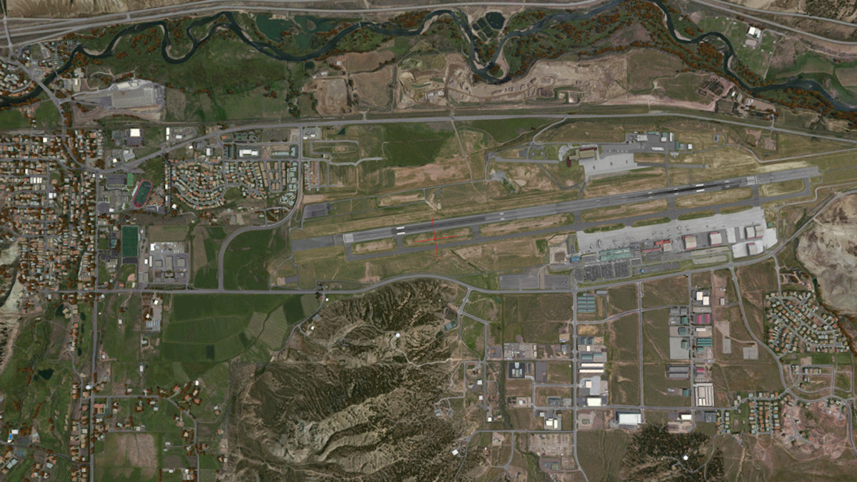 FTX - NA KEGE |
There are a couple of unusual animations you may come across. The first should be easy enough to spot being an animated train running out of Gypsum and the other, an AI helicopter operating near Beaver Creek.
Features
• Massive 1500sq km coverage area at 30cm and 1m resolution covering five towns in Eagle County, Colorado, as well as surrounding
mountain ranges and valleys;
• Ultra Detailed rendition of KEGE Eagle County Regional Airport, Colorado;
• 25 New Static Aircraft Types and Variants, exclusively designed for KEGE;
• Large new fleet of new GSE types specific to Eagle County Airport;
• Advanced rendering, ambient occlusion and unique night-lighting methods used;
• Custom landclass, vector data, custom seasons file and 10m mesh;
• Plenty of VFR landmarks and POI to explore including schools, shopping malls, custom bridges, factories, quarries and many others,
all optimised for performance;
• "Lite" rendition of three landing areas in the coverage zone: Gypsum Creek Ranch (CO47), Avon STOLport (WHR) and Vail Medical Centre.
• Custom Animated AI Helicopter near Beaver Creek Ski Resort;
• Full suite of Object Flow, PeopleFlow2, Texture Flow and more included;
• AI flight plans included for general aviation traffic (freeware FTX NA AI package must be installed from fullterrain.com
• Strongly optimised for good performance with complex aircraft types.
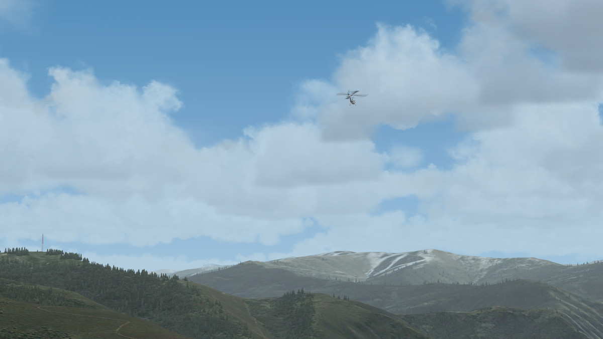 AI Helicopter without Label |
 AI Helicopter with Label |
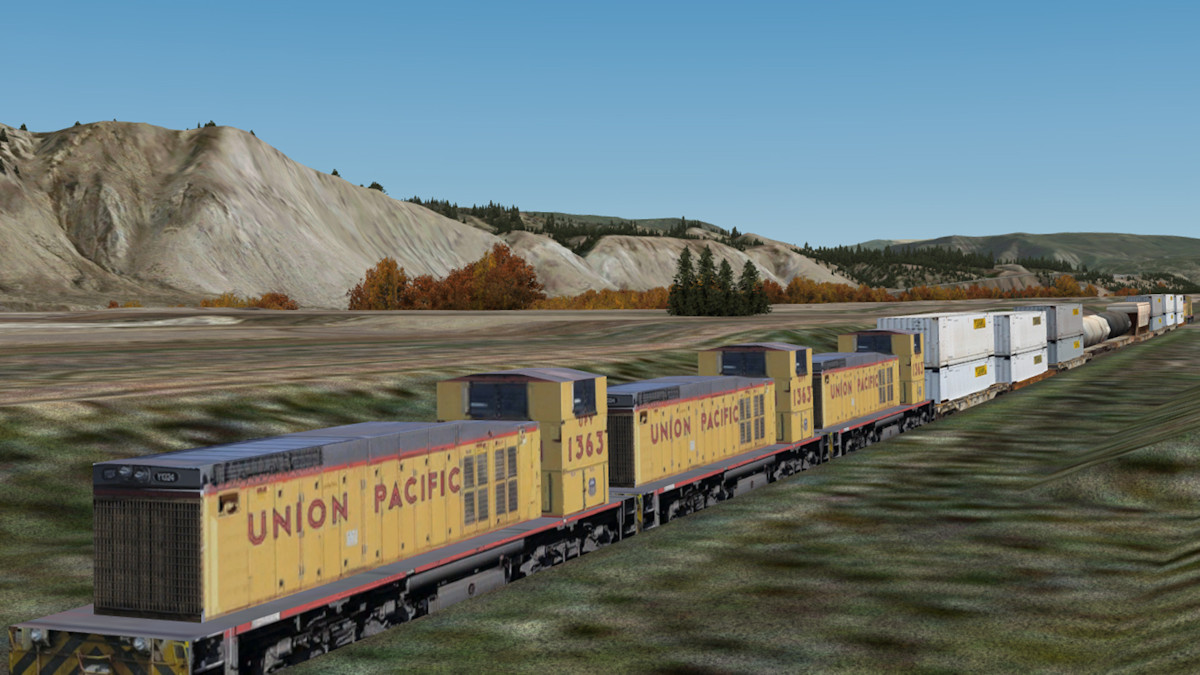 Animated Train |
 Animated People |
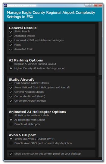
Control Panel
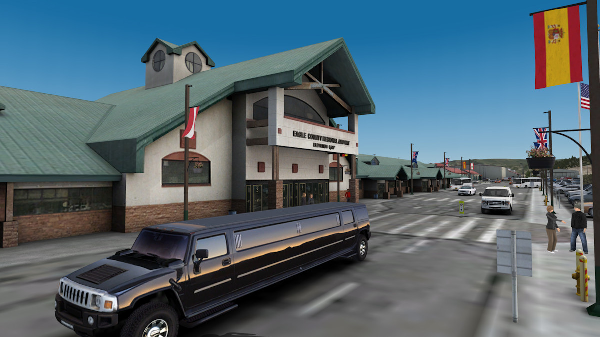
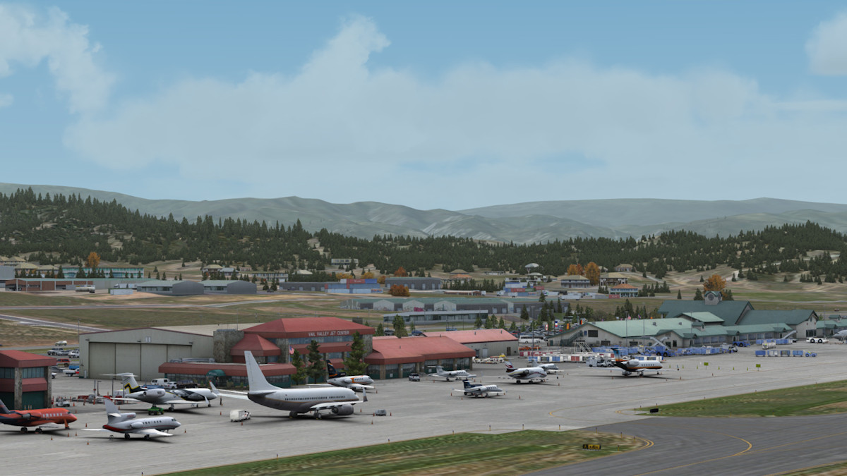
The level of detail in KEGE is extremely good, with the sizeable area both in and around the main KEGE airport being rendered at 30cm resolution and the remaining massive area rendered at 1m resolution. Jarrad has crammed a host of goodies and points of interest into this rendition such as, the custom designed aircraft made especially for KEGE which you will find parked around the airport apron (provided you have them activated in the Control Panel), static and animated people and vehicles, schools, fuel stations, shopping malls not to mention the mass of buildings in and around the various towns and villages. The 30cm resolution ground textures are superb and even the 1m resolution areas are of a high quality and a delight to fly around. Jarrad's attention to detail within the airport boundaries is something very special and you can't help but notice the little nuances that he has included. Some of which are pointed out below but you really need to book your flight in to Eagle County Regional and check it out for yourself.
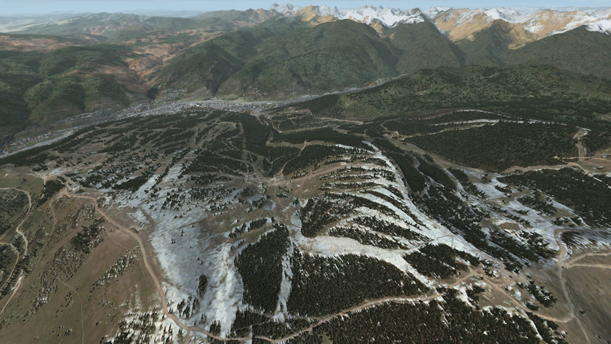
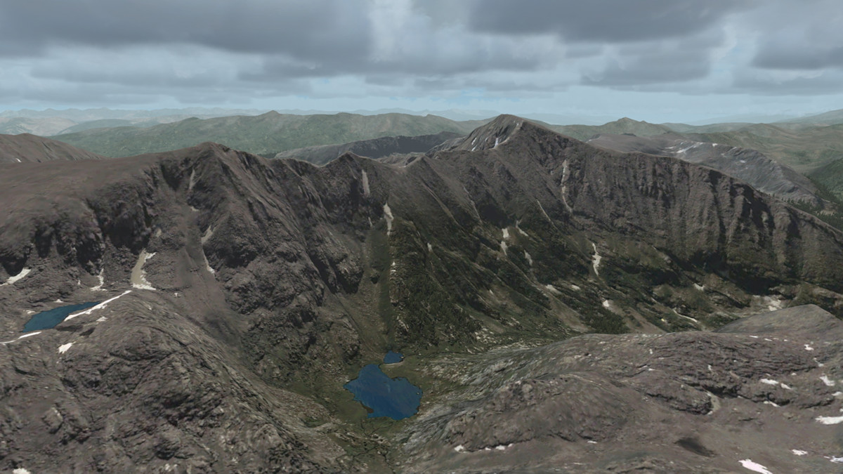
As for the mountain regions and the 1m resolution covered area, I believe the pictures say it all. Crisp textures and seasonal variations all add up to a realistic feeling whilst flying through the myriad of canyons and gullies on your way up to the top of the ski slopes. Not only has Jarrad modelled and coloured the seasonal variations here but he has also gone to the extent of adding in the subtle changes in seasonal snow melt periods. There are very distinct changes happening to the way the snow coverage looks depending on the time and month of the year. A very clever and I believe, unique addition to Orbx scenery add-ons. This feature really gives the scenery some added depth, which you will notice if you fly here throughout the year. The water textures and vectors are also extremely good viewing. All this with barely a twitch on my frame rates and with most of my sliders set to the right for maximum enjoyment.
 Gleaming Limo |
 Terminal Airside |
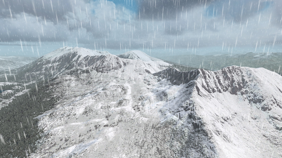 Full Winter |
 Snow Melt |
 Mountain Textures |
 Homestake Reservoir |
 Static Helicopter |
 Turbo Prop Caribou |
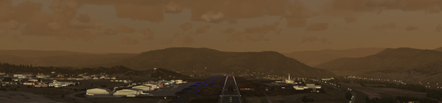
 Terminal Lighting |
 Runway Lighting |
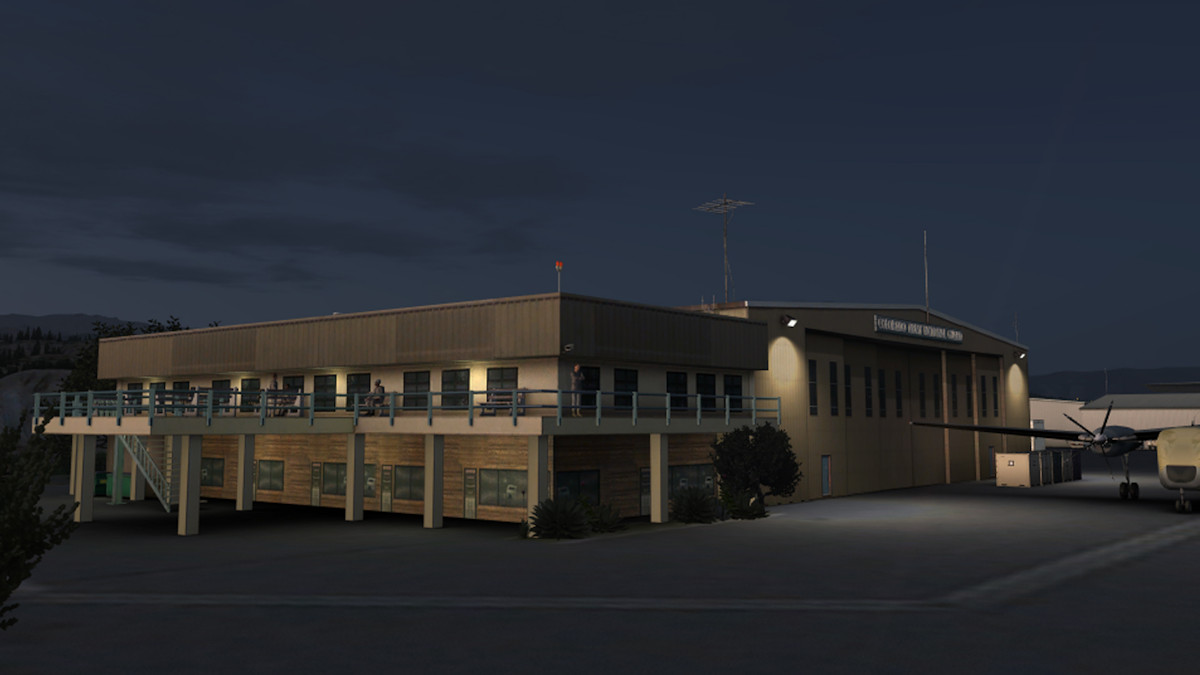 Barracks Lighting |
|
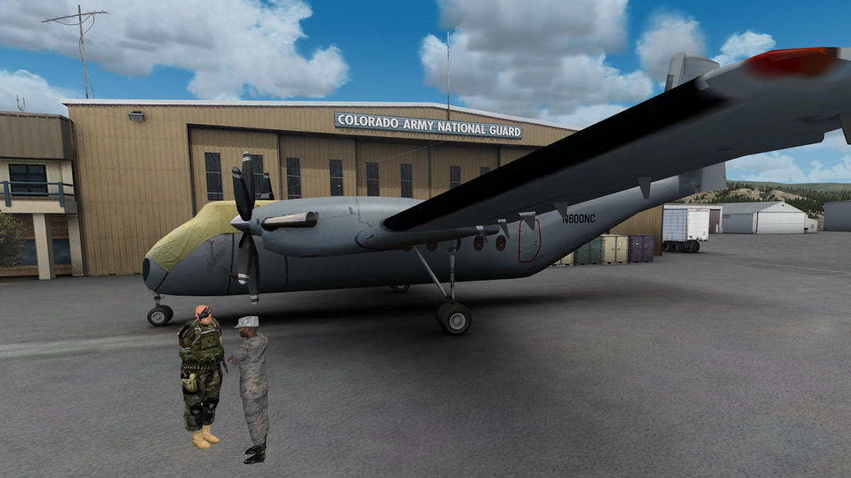
It is evident that Jarrad has spent literally months working on this project, as can be seen in the attention to detail, not just in the quality of most of the buildings, objects and clutter but also in the research he has carried out in determining what to actually include. For example, the basketball hoop at the HAATS base and the Turbo Prop Caribou to name but two. There are loads more. In fact there are hundreds, if not thousands more examples to find and feast your eyes upon.
Jarrad's attention to the quality of the textures, the blending and ambient occlusion is purely and simply outstanding. Although I did manage to find a couple of mishaps that I can only imagine, must creep in to a project of this enormity. As I have stated many times in previous reviews I have done, it is the pedant in me that seeks out these anomalies. Having said that, what I did find does not detract from the overall enjoyment of flying around this marvellous region of Colorado.
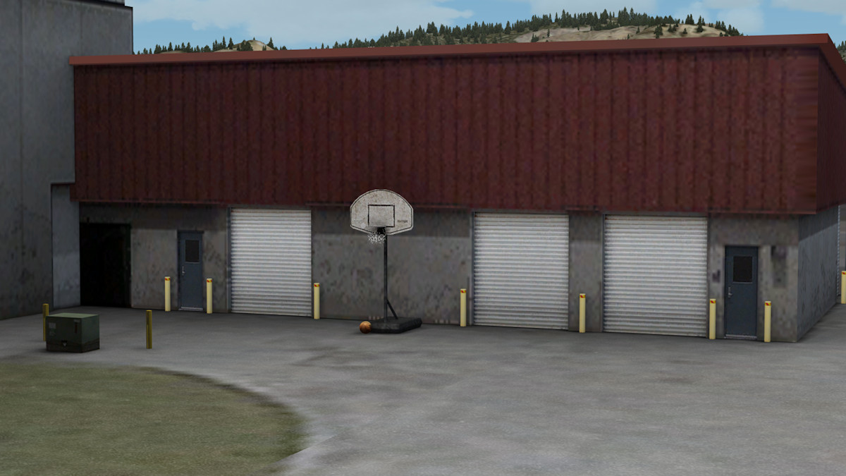 Ball and Hoop |
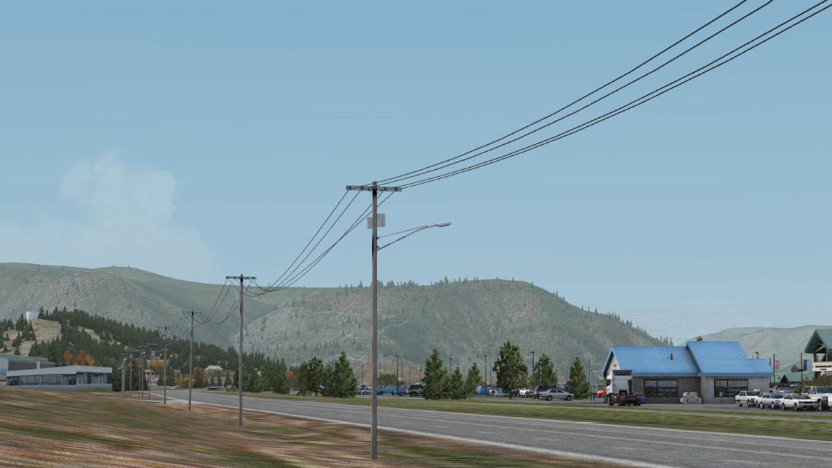 Power Lines |
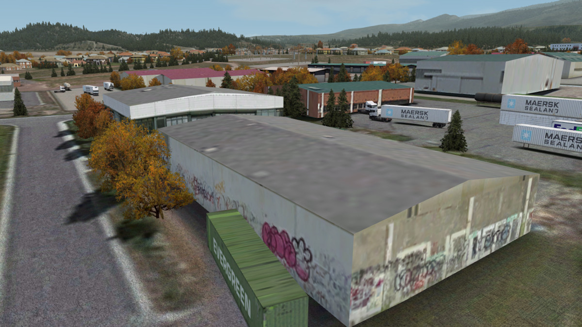 Graffiti |
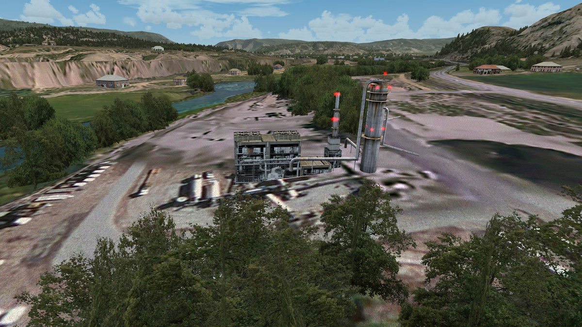 Gypsum Works |
 Costco and Garage |
 Photo Textures |
 National Guard Base |
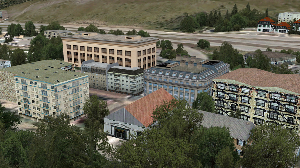 Hotels in Vail |
 Floating Roof |
 Weird Textures |
Documentation
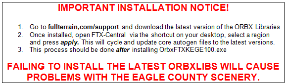
Included in the download is a 22 page PDF file that is a fully comprehensive user manual. It is easy to follow and it takes the user through the usual set up options and has you flying as soon as possible. There is however a particular warning notice warning the user to follow the installation procedure carefully as detailed below.
It also contains all the airport diagrams and charts you need to be able to utilise any of the available runways at Eagle County Airport. Two of the charts are below to give you a flavour of the information covered.
 Airport Diagram |
Airport Logo |
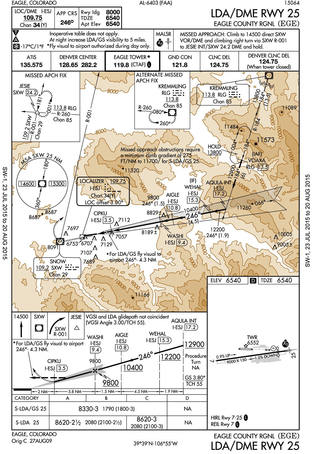 Airport Chart |
Having locked my frame rates in FSX to 31fps, (which is half my monitors refresh rate plus 1, as described in Steve's DX10 Fixer available here
Obviously this may not be the case for everyone, as it is dependent solely on your individual system specifications. On my system I never experienced any adverse effects whatsoever and flying was smooth and free of any flickering, stuttering or OOM errors. KEGE has been strongly optimised for good performance.
Note: This product requires that the .Net 4.5 Framework is installed on your PC. This means that the minimum Operating System required is Windows Vista SP2. Orbx recommends using Windows 7, 8.1 or 10.
Value for Money
At AUD$32.95 and the fact that there are a couple of 'lite' rendered additional airfields and a helipad to use, it goes without saying, that this is terrific value for money. Not to mention the months of dedicated work that Jarrad has poured in to his rendition of Eagle County Regional Airport.
Review Computer Specifications
The specifications of the computer on which the review was conducted are as follows:
• Asus P8Z77-V motherboard, Intel i7 3.4Ghz 'Sandybridge';
• Asus Strix Geforce GTX970 OC 4GB, graphics card;
• 16GB, DDR3, Corsair Vengeance, 2400Mhz RAM;
• 128GB, Corsair Force 3 SSD - OS Windows 7 64 bit;
• 500GB, WD Velociraptor – FSX; and
• additional major add-ons include: Orbx FTX Global BASE; Orbx FTX Global VECTOR; Orbx FTX Global openLC EU; Orbx FTX Trees HD;
Orbx FTX region series; Orbx FTX airport series; and Steve's DX10 Fixer.
Pros:
Massive 1500km sq coverage area.
Two bonus airfields and one helipad.
Superb seasonal texturing.
Optimised for good performance.
Cons:
Minor issues and anomalies.
Conclusion
If you wish to fly 'Rocky Mountain High' and experience one of the toughest approaches that the USA has to offer, then you have to experience Jarrad Marshall's rendition of Eagle County Regional Airport. Thanks Jarrad for another stunner!
| Scores: |
 | |
| ● Scenery Coverage: | 10/10 | |
| ● Level of Detail: | 10/10 | |
| ● Quality of Buildings: | 9.0/10 | |
| ● Documentation: | 10/10 | |
| ● Performance: | 10/10 | |
| ● Value for Money: | 10/10 |
Orbx FTX: NA KEGE Eagle County Airport is awarded a Mutley’s Hangar score of 9.8/10, with an "Outstanding" and a Mutley's Hangar Gold Award. |